Global CityIntelligence

Verified Wikimedia Commons image of Hohe Wand
Hohe Wandabout 15 km (9 mi) from Wiener Neustadt. Image credit: Image: Michael Schmid / Wikimedia Commons, CC BY 2.5

Nature discovery

Nature Near Wiener Neustadt, Austria

Research 16 classified outdoor destinations within weekend reach of Wiener Neustadt, grouped across 8 kinds of place and ordered by measured straight-line distance from the city centre. Distances only — no travel times, schedules, or rankings.

Places listed
16
Closest
Hohe Wand — about 15 km
Furthest listed
about 75 km
Last updated
2026-05-16
Data year
2025

How this list is built

Each place is classified from its own Wikidata type, not from its name, and is ordered by measured straight-line distance from the centre of Wiener Neustadt. Distances are great-circle kilometres between two published coordinates — this page does not publish travel times, transport schedules, opening hours, ticket prices, or rankings. Confirm access, facilities, and seasonal conditions with an official source before travelling.

How far these are

Reachability is a second axis over the same places: the category says what a destination is, the band says how far it sits from Wiener Neustadt. Distances are measured in a straight line — this page publishes no travel times.

  • 13nearby
  • 3day-trip distance

What is out there

  • 5forests
  • 5waterfalls
  • 4mountains
  • 2protected areas
  • 1canyon
  • 1cave
  • 1park
  • 1valley

16 places near Wiener Neustadt

Ordered by straight-line distance from Wiener Neustadt, closest first. Distance bands: nearby is up to 60 km, day-trip distance is up to 120 km.

Places near Wiener Neustadt

Showing all 16 places.

  • Verified Wikimedia Commons image of Hohe Wand
    MountainNearby

    Hohe Wand

    Straight-line distance
    about 15 km (9 mi)
    Recorded type
    mountain

    Hohe Wand is Limestone plateau ridge of the Gutenstein Alps rising above the Vienna Basin, nearby west of Wiener Neustadt; part is a designated nature park. Research access, facilities, and seasonal conditions with official sources before visiting.

    View place Hohe Wand, about 15 km (9 mi) from Wiener Neustadt

    Image credit: Image: Michael Schmid / Wikimedia Commons, CC BY 2.5

  • Verified Wikimedia Commons image of Riparian forest of Schwechat river between Tribuswinkel and Traiskirchen
    ForestNearby

    Riparian forest of Schwechat river between Tribuswinkel and Traiskirchen

    Straight-line distance
    about 21 km (13 mi)
    Recorded type
    riparian forest

    Riparian forest of Schwechat river between Tribuswinkel and Traiskirchen is a forest reachable from Wiener Neustadt as a nearby nature destination. Research access, facilities, and seasonal conditions with official sources before visiting.

    View place Riparian forest of Schwechat river between Tribuswinkel and Traiskirchen, about 21 km (13 mi) from Wiener Neustadt

    Image credit: Image: Clemens Mosch / Wikimedia Commons, CC BY-SA 4.0

  • Verified Wikimedia Commons image of Myra Falls
    WaterfallNearby

    Myra Falls

    Straight-line distance
    about 26 km (16 mi)
    Recorded type
    waterfall

    Myra Falls is Series of waterfalls and ravine cut by the Myrabach near Muggendorf, nearby northwest of Wiener Neustadt. Research access, facilities, and seasonal conditions with official sources before visiting.

    View place Myra Falls, about 26 km (16 mi) from Wiener Neustadt

    Image credit: Image: C.Stadler/Bwag / Wikimedia Commons, CC BY-SA 3.0 at

  • Verified Wikimedia Commons image of Schneeberg
    MountainNearby

    Schneeberg

    Straight-line distance
    about 34 km (21 mi)
    Recorded type
    massif

    Schneeberg is Highest mountain of Lower Austria (), a limestone massif of the Northern Calcareous Alps nearby southwest of Wiener Neustadt. Research access, facilities, and seasonal conditions with official sources before visiting.

    View place Schneeberg, about 34 km (21 mi) from Wiener Neustadt

    Image credit: Image: C.Stadler/Bwag / Wikimedia Commons, CC BY-SA 4.0

  • Verified Wikimedia Commons image of Unterberg
    MountainNearby

    Unterberg

    Straight-line distance
    about 35 km (22 mi)
    Recorded type
    mountain

    Unterberg is Forested limestone peak () in the Gutenstein Alps, nearby northwest of Wiener Neustadt near Pernitz. Research access, facilities, and seasonal conditions with official sources before visiting.

    View place Unterberg, about 35 km (22 mi) from Wiener Neustadt

    Image credit: Image: WA-Wien / Wikimedia Commons, CC BY-SA 3.0

  • Verified Wikimedia Commons image of Hoellental
    CanyonNearby

    Hoellental

    Straight-line distance
    about 37 km (23 mi)
    Recorded type
    slot canyon

    Hoellental is Narrow nearby river valley of the Schwarza between the Schneeberg and Rax massifs, nearby southwest of Wiener Neustadt; part of a Natura 2000 area. Research access, facilities, and seasonal conditions with official sources before visiting.

    View place Hoellental, about 37 km (23 mi) from Wiener Neustadt

    Image credit: Image: C.Stadler/Bwag / Wikimedia Commons, CC BY-SA 3.0

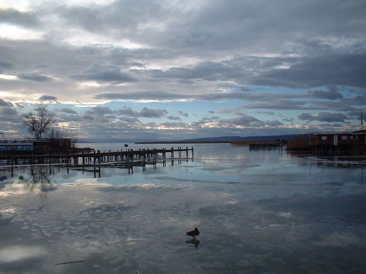
  • Verified Wikimedia Commons image of Lake Neusiedl
    Protected areaNearby

    Lake Neusiedl

    Straight-line distance
    about 37 km (23 mi)
    Recorded type
    Natura 2000 site

    Lake Neusiedl is Large endorheic steppe lake straddling Austria and Hungary and a UNESCO site, nearby east of Wiener Neustadt. Research access, facilities, and seasonal conditions with official sources before visiting.

    View place Lake Neusiedl, about 37 km (23 mi) from Wiener Neustadt

    Image credit: Image: Lutz Fischer-Lamprecht / Wikimedia Commons, CC BY-SA 4.0

  • Verified Wikimedia Commons image of Semmering Pass
    MountainNearby

    Semmering Pass

    Straight-line distance
    about 38 km (23 mi)
    Recorded type
    mountain pass

    Semmering Pass is Mountain pass () in the Northern Limestone Alps forming the Lower Austria-Styria border, nearby southwest of Wiener Neustadt. Research access, facilities, and seasonal conditions with official sources before visiting.

    View place Semmering Pass, about 38 km (23 mi) from Wiener Neustadt

    Image credit: Image: The original uploader was Popmuseum at German Wikipedia. (Original text: Popmuseum 23:05, 3. Aug. 2007 (CEST)) / Wikimedia Commons, CC BY-SA 3.0

  • Verified Wikimedia Commons image of Vienna Woods
    ForestNearby

    Vienna Woods

    Straight-line distance
    about 39 km (24 mi)
    Recorded type
    forest

    Vienna Woods is Forested highlands forming the foothills of the Northern Limestone Alps and a biosphere reserve, extending north and northwest of Wiener Neustadt. Research access, facilities, and seasonal conditions with official sources before visiting.

    View place Vienna Woods, about 39 km (24 mi) from Wiener Neustadt

    Image credit: Image: Karl Gruber / Wikimedia Commons, CC BY-SA 3.0

  • Verified Wikimedia Commons image of Lassingfall
    WaterfallDay-trip distance

    Lassingfall

    Straight-line distance
    about 71 km (44 mi)
    Recorded type
    waterfall

    Lassingfall is a waterfall reachable from Wiener Neustadt as a nearby nature destination. Research access, facilities, and seasonal conditions with official sources before visiting.

    View place Lassingfall, about 71 km (44 mi) from Wiener Neustadt

    Image credit: Image: Duke of W4 / Wikimedia Commons, CC BY-SA 4.0

  • Verified Wikimedia Commons image of Mira Fall
    WaterfallDay-trip distance

    Mira Fall

    Straight-line distance
    about 75 km (46 mi)
    Recorded type
    waterfall

    Mira Fall is a waterfall reachable from Wiener Neustadt as a nearby nature destination. Research access, facilities, and seasonal conditions with official sources before visiting.

    View place Mira Fall, about 75 km (46 mi) from Wiener Neustadt

    Image credit: Image: The original uploader was Geof at German Wikipedia . / Wikimedia Commons, CC BY-SA 3.0