Global CityIntelligence

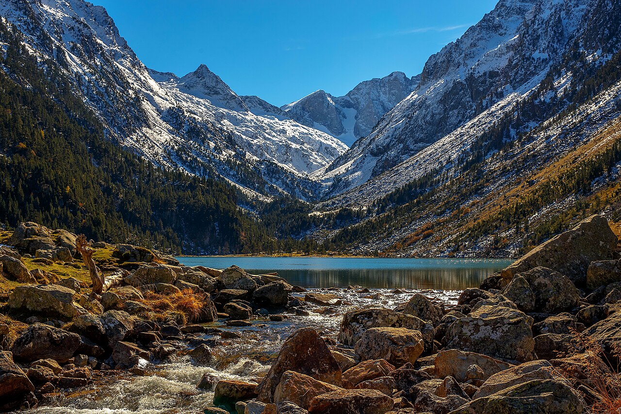
Verified Wikimedia Commons image of Pic du Midi de Bigorre
Pic du Midi de Bigorreabout 33 km (21 mi) from Tarbes. Image credit: Image: Albgr03 / Wikimedia Commons, CC BY-SA 4.0

Nature discovery

Nature Near Tarbes, France

Research 18 classified outdoor destinations within weekend reach of Tarbes, grouped across 7 kinds of place and ordered by measured straight-line distance from the city centre. Distances only — no travel times, schedules, or rankings.

Places listed
18
Closest
Pic du Midi de Bigorre — about 33 km
Furthest listed
about 117 km
Last updated
2026-05-16
Data year
2025

How this list is built

Each place is classified from its own Wikidata type, not from its name, and is ordered by measured straight-line distance from the centre of Tarbes. Distances are great-circle kilometres between two published coordinates — this page does not publish travel times, transport schedules, opening hours, ticket prices, or rankings. Confirm access, facilities, and seasonal conditions with an official source before travelling.

How far these are

Reachability is a second axis over the same places: the category says what a destination is, the band says how far it sits from Tarbes. Distances are measured in a straight line — this page publishes no travel times.

  • 9nearby
  • 9day-trip distance

What is out there

  • 8protected areas
  • 5forests
  • 5waterfalls
  • 3mountains
  • 1cave
  • 1lake
  • 1national park

18 places near Tarbes

Ordered by straight-line distance from Tarbes, closest first. Distance bands: nearby is up to 60 km, day-trip distance is up to 120 km.

Places near Tarbes

Showing all 18 places.

  • Verified Wikimedia Commons image of Col du Tourmalet
    MountainNearby

    Col du Tourmalet

    Straight-line distance
    about 37 km (23 mi)
    Recorded type
    mountain pass

    Col du Tourmalet is high mountain pass in the Hautes-Pyrénées, nearby south of Tarbes. Research access, facilities, and seasonal conditions with official sources before visiting.

    View place Col du Tourmalet, about 37 km (23 mi) from Tarbes

    Image credit: Image: Itzuvit / Wikimedia Commons, CC BY-SA 2.5

  • Verified Wikimedia Commons image of Néouvielle National Nature Reserve
    Protected areaNearby

    Néouvielle National Nature Reserve

    Straight-line distance
    about 44 km (27 mi)
    Recorded type
    national nature reserve

    Néouvielle National Nature Reserve is High-altitude reserve with more than 70 glacial lakes in the Néouvielle massif, nearby southeast of Tarbes. Research access, facilities, and seasonal conditions with official sources before visiting.

    View place Néouvielle National Nature Reserve, about 44 km (27 mi) from Tarbes

    Image credit: Image: PIERRE ANDRE LECLERCQ / Wikimedia Commons, CC BY-SA 4.0

  • Verified Wikimedia Commons image of Pont d'Espagne
    Protected areaNearby

    Pont d'Espagne

    Straight-line distance
    about 46 km (29 mi)
    Recorded type
    protected area

    Pont d'Espagne is Mountain confluence with waterfalls at about above Cauterets, nearby south of Tarbes. Research access, facilities, and seasonal conditions with official sources before visiting.

    View place Pont d'Espagne, about 46 km (29 mi) from Tarbes

    Image credit: Image: Jean-Christophe BENOIST / Wikimedia Commons, CC BY 3.0

  • Verified Wikimedia Commons image of Gaube Lake
    LakeNearby

    Gaube Lake

    Straight-line distance
    about 48 km (30 mi)
    Recorded type
    glacial lake

    Gaube Lake is Glacial lake at facing the Vignemale, in the Cauterets valley nearby south of Tarbes. Research access, facilities, and seasonal conditions with official sources before visiting.

    View place Gaube Lake, about 48 km (30 mi) from Tarbes

    Image credit: Image: Orlando Mouchel / Wikimedia Commons, CC BY-SA 4.0

  • Verified Wikimedia Commons image of Pyrenees National Park
    National parkNearby

    Pyrenees National Park

    Straight-line distance
    about 49 km (31 mi)
    Recorded type
    national park

    Pyrenees National Park is French national park along the Spanish border with high peaks, lakes and forests, beginning nearby south of Tarbes. Research access, facilities, and seasonal conditions with official sources before visiting.

    View place Pyrenees National Park, about 49 km (31 mi) from Tarbes

    Image credit: Image: W. Bulach / Wikimedia Commons, CC BY-SA 4.0

  • Verified Wikimedia Commons image of cave of Gèdre
    WaterfallNearby

    cave of Gèdre

    Straight-line distance
    about 50 km (31 mi)
    Recorded type
    waterfall

    cave of Gèdre is a waterfall reachable from Tarbes as a nearby nature destination. Research access, facilities, and seasonal conditions with official sources before visiting.

    View place cave of Gèdre, about 50 km (31 mi) from Tarbes

    Image credit: Image: Andrieu, J.. Fonction indéterminée / Wikimedia Commons, Public Domain

  • Verified Wikimedia Commons image of Vignemale
    MountainNearby

    Vignemale

    Straight-line distance
    about 54 km (34 mi)
    Recorded type
    mountain

    Vignemale is At the highest French Pyrenean summit, on the Franco-Spanish border nearby south of Tarbes. Research access, facilities, and seasonal conditions with official sources before visiting.

    View place Vignemale, about 54 km (34 mi) from Tarbes

    Image credit: Image: User Sea-empress on de.wikipedia / Wikimedia Commons, CC BY-SA 3.0

  • Verified Wikimedia Commons image of Cirque de Gavarnie
    Protected areaDay-trip distance

    Cirque de Gavarnie

    Straight-line distance
    about 60 km (37 mi)
    Recorded type
    Natura 2000 site

    Cirque de Gavarnie is Large glacial cirque and UNESCO World Heritage site in the central Pyrenees, nearby south of Tarbes. Research access, facilities, and seasonal conditions with official sources before visiting.

    View place Cirque de Gavarnie, about 60 km (37 mi) from Tarbes

    Image credit: Image: No machine-readable author provided. Miguel303xm~commonswiki assumed (based on copyright claims). / Wikimedia Commons, CC BY-SA 2.5

  • Verified Wikimedia Commons image of Gavarnie Falls
    WaterfallDay-trip distance

    Gavarnie Falls

    Straight-line distance
    about 60 km (37 mi)
    Recorded type
    waterfall

    Gavarnie Falls is a waterfall reachable from Tarbes as a nearby nature destination. Research access, facilities, and seasonal conditions with official sources before visiting.

    View place Gavarnie Falls, about 60 km (37 mi) from Tarbes

    Image credit: Image: Jean-Christophe BENOIST / Wikimedia Commons, CC BY 3.0

  • Verified Wikimedia Commons image of Cascade d'Ars
    WaterfallDay-trip distance

    Cascade d'Ars

    Straight-line distance
    about 117 km (73 mi)
    Recorded type
    waterfall

    Cascade d'Ars is a waterfall reachable from Tarbes as a nearby nature destination. Research access, facilities, and seasonal conditions with official sources before visiting.

    View place Cascade d'Ars, about 117 km (73 mi) from Tarbes

    Image credit: Image: PierreG 09 (Pierre Goujet) / Wikimedia Commons, CC BY-SA 4.0