Global CityIntelligence

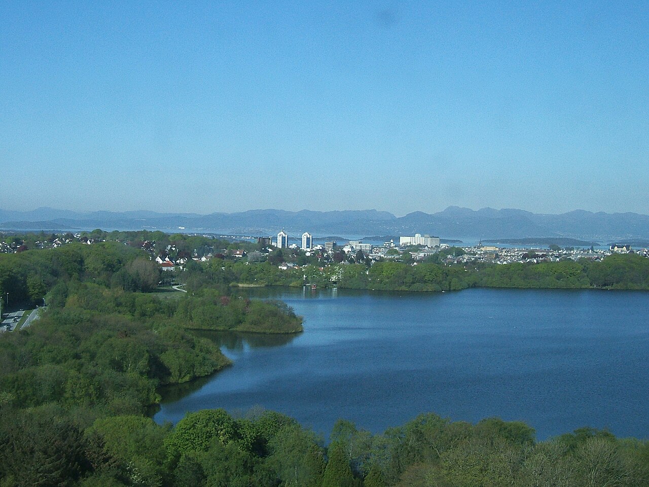
Verified Wikimedia Commons image of Mosvatnet
Mosvatnetabout 2 km (1 mi) from Stavanger. Image credit: Image: Peter Van den Bossche / Wikimedia Commons, CC BY-SA 2.0

Nature discovery

Nature Near Stavanger, Norway

Research 14 classified outdoor destinations within weekend reach of Stavanger, grouped across 5 kinds of place and ordered by measured straight-line distance from the city centre. Distances only — no travel times, schedules, or rankings.

Places listed
14
Closest
Mosvatnet — about 2 km
Furthest listed
about 112 km
Last updated
2026-05-16
Data year
2025

How this list is built

Each place is classified from its own Wikidata type, not from its name, and is ordered by measured straight-line distance from the centre of Stavanger. Distances are great-circle kilometres between two published coordinates — this page does not publish travel times, transport schedules, opening hours, ticket prices, or rankings. Confirm access, facilities, and seasonal conditions with an official source before travelling.

How far these are

Reachability is a second axis over the same places: the category says what a destination is, the band says how far it sits from Stavanger. Distances are measured in a straight line — this page publishes no travel times.

  • 10nearby
  • 4day-trip distance

What is out there

  • 6coast and headlands
  • 5waterfalls
  • 1lake
  • 1mountain
  • 1protected area

14 places near Stavanger

Ordered by straight-line distance from Stavanger, closest first. Distance bands: nearby is up to 60 km, day-trip distance is up to 120 km.

Places near Stavanger

Showing all 14 places.

  • Verified Wikimedia Commons image of Mosvatnet
    LakeNearby

    Mosvatnet

    Straight-line distance
    about 2 km (1 mi)
    Recorded type
    lake

    Mosvatnet is 45-hectare lake bordered by Valandsskogen forest, a birdlife recreation area just west of central Stavanger. Research access, facilities, and seasonal conditions with official sources before visiting.

    View place Mosvatnet, about 2 km (1 mi) from Stavanger

    Image credit: Image: Peter Van den Bossche / Wikimedia Commons, CC BY-SA 2.0

  • Verified Wikimedia Commons image of Gandsfjord
    CoastNearby

    Gandsfjord

    Straight-line distance
    about 7 km (4 mi)
    Recorded type
    fjord

    Gandsfjord is a fjord reachable from Stavanger as a nearby nature destination. Research access, facilities, and seasonal conditions with official sources before visiting.

    View place Gandsfjord, about 7 km (4 mi) from Stavanger

    Image credit: Image: Alexey Topolyanskiy / Wikimedia Commons, CC0

  • Verified Wikimedia Commons image of Hafrsfjord
    CoastNearby

    Hafrsfjord

    Straight-line distance
    about 7 km (4 mi)
    Recorded type
    fjord

    Hafrsfjord is a fjord reachable from Stavanger as a nearby nature destination. Research access, facilities, and seasonal conditions with official sources before visiting.

    View place Hafrsfjord, about 7 km (4 mi) from Stavanger

    Image credit: Image: kallerna / Wikimedia Commons, CC BY-SA 4.0

  • Verified Wikimedia Commons image of Høgsfjord
    CoastNearby

    Høgsfjord

    Straight-line distance
    about 19 km (12 mi)
    Recorded type
    fjord

    Høgsfjord is a fjord reachable from Stavanger as a nearby nature destination. Research access, facilities, and seasonal conditions with official sources before visiting.

    View place Høgsfjord, about 19 km (12 mi) from Stavanger

    Image credit: Image: Hallvard Nygård / Wikimedia Commons, CC BY-SA 3.0

  • Verified Wikimedia Commons image of Boknafjord
    CoastNearby

    Boknafjord

    Straight-line distance
    about 25 km (15 mi)
    Recorded type
    fjord

    Boknafjord is a fjord reachable from Stavanger as a nearby nature destination. Research access, facilities, and seasonal conditions with official sources before visiting.

    View place Boknafjord, about 25 km (15 mi) from Stavanger

    Image credit: Image: Frokor / Wikimedia Commons, CC BY-SA 3.0

  • Verified Wikimedia Commons image of Lysefjord
    CoastNearby

    Lysefjord

    Straight-line distance
    about 36 km (22 mi)
    Recorded type
    fjord

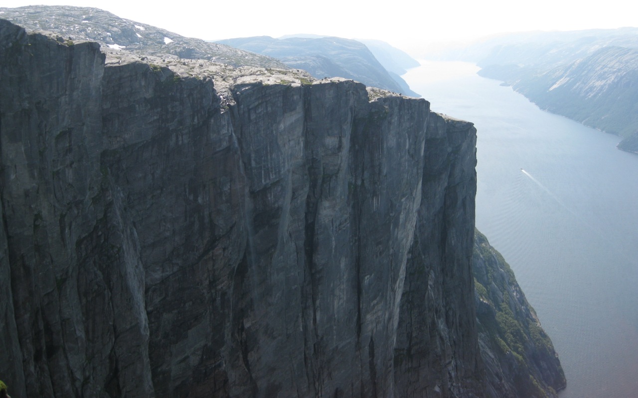
    Lysefjord is nearby glacially carved fjord in Ryfylke, nearby east of Stavanger, flanked by steep granite walls. Research access, facilities, and seasonal conditions with official sources before visiting.

    View place Lysefjord, about 36 km (22 mi) from Stavanger

    Image credit: Image: W. Bulach / Wikimedia Commons, CC BY-SA 4.0

  • Verified Wikimedia Commons image of Manafossen
    WaterfallNearby

    Manafossen

    Straight-line distance
    about 39 km (24 mi)
    Recorded type
    waterfall

    Manafossen is single-drop waterfall on the river Manaana near Frafjord in Gjesdal, nearby southeast of Stavanger. Research access, facilities, and seasonal conditions with official sources before visiting.

    View place Manafossen, about 39 km (24 mi) from Stavanger

    Image credit: Image: No machine-readable author provided. Gunnernett assumed (based on copyright claims). / Wikimedia Commons, CC BY-SA 3.0

  • Verified Wikimedia Commons image of Kjeragfossen
    WaterfallNearby

    Kjeragfossen

    Straight-line distance
    about 49 km (31 mi)
    Recorded type
    waterfall

    Kjeragfossen is Seasonal plunge waterfall about high dropping from the Kjerag plateau into the Lysefjord, east of Stavanger. Research access, facilities, and seasonal conditions with official sources before visiting.

    View place Kjeragfossen, about 49 km (31 mi) from Stavanger

    Image credit: Image: Håvard Thoen / Wikimedia Commons, CC BY 2.0

  • Verified Wikimedia Commons image of Kjerag
    MountainNearby

    Kjerag

    Straight-line distance
    about 50 km (31 mi)
    Recorded type
    mountain

    Kjerag is mountain on the south shore of the Lysefjord with a near-vertical cliff, nearby east of Stavanger. Research access, facilities, and seasonal conditions with official sources before visiting.

    View place Kjerag, about 50 km (31 mi) from Stavanger

    Image credit: Image: Kjwathne / Wikimedia Commons, CC BY 3.0

  • Verified Wikimedia Commons image of Magma Geopark
    Protected areaDay-trip distance

    Magma Geopark

    Straight-line distance
    about 62 km (39 mi)
    Recorded type
    geopark

    Magma Geopark is UNESCO Global Geopark of anorthosite rock landscape across municipalities around Egersund, south of Stavanger. Research access, facilities, and seasonal conditions with official sources before visiting.

    View place Magma Geopark, about 62 km (39 mi) from Stavanger

    Image credit: Image: Mikenorton / Wikimedia Commons, CC BY-SA 4.0

  • Verified Wikimedia Commons image of Langfossen
    WaterfallDay-trip distance

    Langfossen

    Straight-line distance
    about 103 km (64 mi)
    Recorded type
    waterfall

    Langfossen is a waterfall reachable from Stavanger as a nearby nature destination. Research access, facilities, and seasonal conditions with official sources before visiting.

    View place Langfossen, about 103 km (64 mi) from Stavanger

    Image credit: Image: Frokor / Wikimedia Commons, CC BY-SA 4.0

  • Verified Wikimedia Commons image of Reiårsfossen
    WaterfallDay-trip distance

    Reiårsfossen

    Straight-line distance
    about 112 km (70 mi)
    Recorded type
    waterfall

    Reiårsfossen is a waterfall reachable from Stavanger as a nearby nature destination. Research access, facilities, and seasonal conditions with official sources before visiting.

    View place Reiårsfossen, about 112 km (70 mi) from Stavanger

    Image credit: Image: TheGunslinger666 / Wikimedia Commons, CC BY-SA 4.0