Research source-backed public places within weekend reach of Stavanger. The records on this page are planning candidates — not a route planner, not a tourism ranking, not a live schedule, and not a price guide. Verify access, transport, weather, opening status, and seasonal conditions with the official source linked on each record before departure.
This page helps users research nearby weekend places connected to Stavanger, Norway, as a starting point for local-first weekend rest. It is not a route planner, ticket guide, events page, tourism ranking, or live availability source. Records are planning candidates only.
Records do not publish exact distances, travel times, transport schedules, opening hours, ticket prices, restaurant or hotel recommendations, attraction rankings, or live access status. Confirm time-sensitive details with the official park, museum, transport authority, or municipal source linked on each record.
Each card opens an official source where Wikidata lists one, plus links to the connected city, country profile, and the detail page for verified records. Records are unordered and not ranked; verify access and conditions with the official source before departure.
Jaeren is Coastal lowland district with Norway's longest sand beaches and a protected landscape area, south and southwest of Stavanger. Research access, facilities, and seasonal conditions with official sources before visiting.
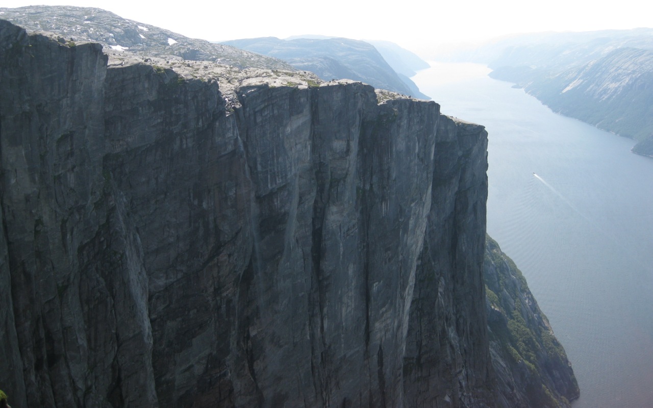
Kjerag is mountain on the south shore of the Lysefjord with a near-vertical cliff, nearby east of Stavanger. Research access, facilities, and seasonal conditions with official sources before visiting.
Kjeragfossen is Seasonal plunge waterfall about high dropping from the Kjerag plateau into the Lysefjord, east of Stavanger. Research access, facilities, and seasonal conditions with official sources before visiting.
Lysefjord is nearby glacially carved fjord in Ryfylke, nearby east of Stavanger, flanked by steep granite walls. Research access, facilities, and seasonal conditions with official sources before visiting.
Magma Geopark is UNESCO Global Geopark of anorthosite rock landscape across municipalities around Egersund, south of Stavanger. Research access, facilities, and seasonal conditions with official sources before visiting.
Manafossen is single-drop waterfall on the river Manaana near Frafjord in Gjesdal, nearby southeast of Stavanger. Research access, facilities, and seasonal conditions with official sources before visiting.
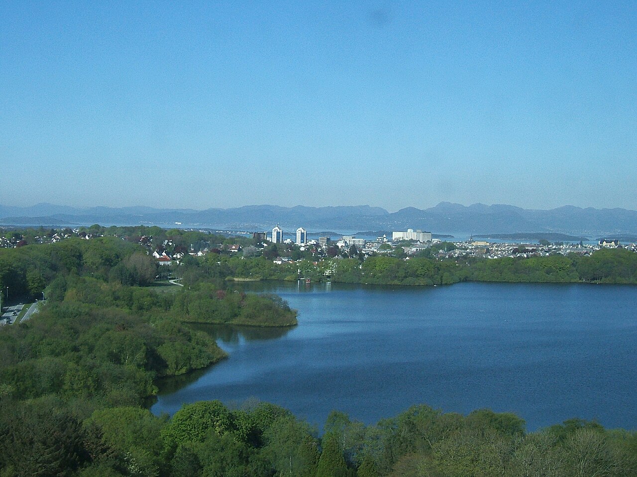
Mosvatnet is 45-hectare lake bordered by Valandsskogen forest, a birdlife recreation area just west of central Stavanger. Research access, facilities, and seasonal conditions with official sources before visiting.
Preikestolen (Pulpit Rock) is Steep cliff plateau rising about above the Lysefjord in Ryfylke, nearby east of Stavanger. Research access, facilities, and seasonal conditions with official sources before visiting.
This page is a planning surface. Records do not publish exact distances, travel times, transport schedules, opening hours, ticket prices, restaurant or hotel recommendations, attraction rankings, or live access status.
Start with the Stavanger city profile to anchor the location and country context.
Compare the nearby place records above against your origin city’s transport and access patterns.
Open the detail page for any record marked “Verified source record” to see the official source, Wikidata identity, and visual context.
Check the official source linked on each record for current opening, access, seasonal status, and conditions before departure.
Use the travel budget calculator for user-entered estimates — the platform does not publish ticket prices, transport schedules, or hotel/flight prices.
Confirm route, weather, opening/access status, and costs from official or trusted current sources before departure.
Verification status legend
The status shown on each card reflects the level of source verification: a matched Wikidata identity together with an official URL is shown as verified, an identity match without a confirmed official URL is shown as partially verified, and records not yet matched to a stable identifier are shown as pending review.
Verified source record
1
Partially verified source record
7
Sources and methodology
Nearby weekend places are sourced exclusively from Wikidata — primary identifier (QID), coordinates (P625), and official website (P856) — together with the linked operator (park authority, municipality, heritage body, or UNESCO official page) where Wikidata’s P856 points at it. Records do not publish fixed itineraries, attraction rankings, restaurant or hotel recommendations, event or festival dates, ticket prices, hotel or flight prices, opening hours, transport schedules, exact travel times, exact distances, weather forecasts, crime rates, or any “best” / “must-see” / “safest” / “cheapest” claims. Verify access, opening times, weather, health, and safety details with the official source linked on each record before departure. Read the scoring methodology for how structured indicators are constructed, and the data sources registry for the official publishers cited across the platform.
Continue exploring
Open related platform layers behind Stavanger weekend research. Verify events, opening hours, transport, weather, health, and safety details with official or trusted current sources before departure.