Global CityIntelligence

Verified Wikimedia Commons image of Cedars of Lebanon State Park
Cedars of Lebanon State Parkabout 26 km (16 mi) from Murfreesboro. Image credit: Image: Brian Stansberry / Wikimedia Commons, CC BY 3.0

Nature discovery

Nature Near Murfreesboro, United States

Research 11 classified outdoor destinations within weekend reach of Murfreesboro, grouped across 4 kinds of place and ordered by measured straight-line distance from the city centre. Distances only — no travel times, schedules, or rankings.

Places listed
11
Closest
Cedars of Lebanon State Park — about 26 km
Furthest listed
about 96 km
Last updated
2026-05-16
Data year
2025

How this list is built

Each place is classified from its own Wikidata type, not from its name, and is ordered by measured straight-line distance from the centre of Murfreesboro. Distances are great-circle kilometres between two published coordinates — this page does not publish travel times, transport schedules, opening hours, ticket prices, or rankings. Confirm access, facilities, and seasonal conditions with an official source before travelling.

How far these are

Reachability is a second axis over the same places: the category says what a destination is, the band says how far it sits from Murfreesboro. Distances are measured in a straight line — this page publishes no travel times.

  • 4nearby
  • 7day-trip distance

What is out there

  • 5waterfalls
  • 3parks
  • 2lakes
  • 1river

11 places near Murfreesboro

Ordered by straight-line distance from Murfreesboro, closest first. Distance bands: nearby is up to 60 km, day-trip distance is up to 120 km.

Places near Murfreesboro

Showing all 11 places.

  • Verified Wikimedia Commons image of J. Percy Priest Lake
    LakeNearby

    J. Percy Priest Lake

    Straight-line distance
    about 40 km (25 mi)
    Recorded type
    reservoir

    J. Percy Priest Lake is Army Corps reservoir on the Stones River about 25-nearby northwest of Murfreesboro, spanning Rutherford, Davidson and Wilson counties. Research access, facilities, and seasonal conditions with official sources before visiting.

    View place J. Percy Priest Lake, about 40 km (25 mi) from Murfreesboro

    Image credit: Image: U.S. Army Corps of Engineers from USA / Wikimedia Commons, CC BY 2.0

  • Verified Wikimedia Commons image of Stones River
    RiverNearby

    Stones River

    Straight-line distance
    about 46 km (28 mi)
    Recorded type
    stream

    Stones River is River of the Nashville Basin whose West Fork runs just west of downtown Murfreesboro; greenways and riparian woods along its banks. Research access, facilities, and seasonal conditions with official sources before visiting.

    View place Stones River, about 46 km (28 mi) from Murfreesboro

    Image credit: Image: Casey Fleser / Wikimedia Commons, CC BY 2.0

  • Verified Wikimedia Commons image of Rock Island State Park
    WaterfallDay-trip distance

    Rock Island State Park

    Straight-line distance
    about 68 km (42 mi)
    Recorded type
    waterfall

    Rock Island State Park is State park on the Caney Fork featuring the Great Falls Gorge and cascade waterfalls, nearby southeast of Murfreesboro on the Cumberland Plateau edge. Research access, facilities, and seasonal conditions with official sources before visiting.

    View place Rock Island State Park, about 68 km (42 mi) from Murfreesboro

    Image credit: Image: This image was created by user Brian Adamo (adamo588) at Mushroom Observer, a source for mycological images.You can contact this user here. / Wikimedia Commons, CC0

  • Verified Wikimedia Commons image of Greater Falls
    WaterfallDay-trip distance

    Greater Falls

    Straight-line distance
    about 69 km (43 mi)
    Recorded type
    waterfall

    Greater Falls is a waterfall reachable from Murfreesboro as a nearby nature destination. Research access, facilities, and seasonal conditions with official sources before visiting.

    View place Greater Falls, about 69 km (43 mi) from Murfreesboro

    Image credit: Image: Sharon Mollerus from Minneapolis, United States / Wikimedia Commons, CC BY 2.0

  • Verified Wikimedia Commons image of Burgess Falls
    WaterfallDay-trip distance

    Burgess Falls

    Straight-line distance
    about 75 km (47 mi)
    Recorded type
    waterfall

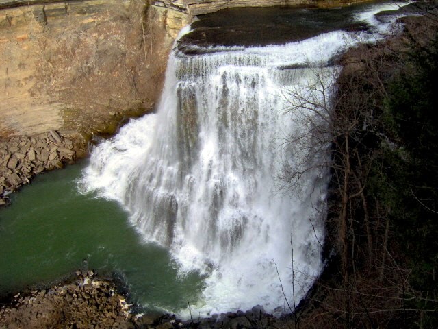
    Burgess Falls is a waterfall reachable from Murfreesboro as a nearby nature destination. Research access, facilities, and seasonal conditions with official sources before visiting.

    View place Burgess Falls, about 75 km (47 mi) from Murfreesboro

    Image credit: Image: Brian Stansberry / Wikimedia Commons, CC BY 3.0

  • Verified Wikimedia Commons image of Burgess Falls State Park
    ParkDay-trip distance

    Burgess Falls State Park

    Straight-line distance
    about 75 km (47 mi)
    Recorded type
    Park

    Burgess Falls State Park is Day-use park where the Falling Water River drops through a gorge in a series of falls including a cataract, nearby east of Murfreesboro. Research access, facilities, and seasonal conditions with official sources before visiting.

    View place Burgess Falls State Park, about 75 km (47 mi) from Murfreesboro

    Image credit: Image: Brian Stansberry / Wikimedia Commons, CC BY 3.0

  • Verified Wikimedia Commons image of Cummins Falls State Park
    ParkDay-trip distance

    Cummins Falls State Park

    Straight-line distance
    about 87 km (54 mi)
    Recorded type
    Park

    Cummins Falls State Park is Park centered on a waterfall on the Blackburn Fork in a river gorge, northwest of Cookeville nearby northeast of Murfreesboro. Research access, facilities, and seasonal conditions with official sources before visiting.

    View place Cummins Falls State Park, about 87 km (54 mi) from Murfreesboro

    Image credit: Image: Brenton Rogers from Cumberland Gap, TN / Wikimedia Commons, CC BY 2.0