Global CityIntelligence

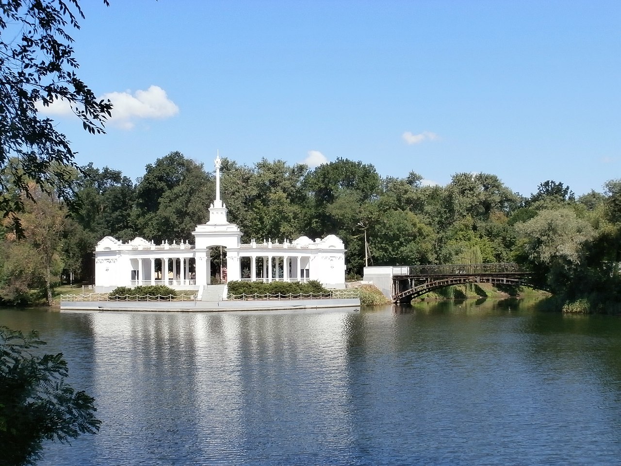
Verified Wikimedia Commons image of Inhulets River
Inhulets Riverabout 26 km (16 mi) from Kropyvnytskyi. Image credit: Image: Berihert / Wikimedia Commons, CC BY-SA 3.0

Nature discovery

Nature Near Kropyvnytskyi, Ukraine

Research 13 classified outdoor destinations within weekend reach of Kropyvnytskyi, grouped across 7 kinds of place and ordered by measured straight-line distance from the city centre. Distances only — no travel times, schedules, or rankings.

Places listed
13
Closest
Inhulets River — about 26 km
Furthest listed
about 117 km
Last updated
2026-05-16
Data year
2025

How this list is built

Each place is classified from its own Wikidata type, not from its name, and is ordered by measured straight-line distance from the centre of Kropyvnytskyi. Distances are great-circle kilometres between two published coordinates — this page does not publish travel times, transport schedules, opening hours, ticket prices, or rankings. Confirm access, facilities, and seasonal conditions with an official source before travelling.

How far these are

Reachability is a second axis over the same places: the category says what a destination is, the band says how far it sits from Kropyvnytskyi. Distances are measured in a straight line — this page publishes no travel times.

  • 3nearby
  • 10day-trip distance

What is out there

  • 5forests
  • 4protected areas
  • 3rivers
  • 1canyon
  • 1lake
  • 1national park
  • 1valley

13 places near Kropyvnytskyi

Ordered by straight-line distance from Kropyvnytskyi, closest first. Distance bands: nearby is up to 60 km, day-trip distance is up to 120 km.

Places near Kropyvnytskyi

Showing all 13 places.

  • Verified Wikimedia Commons image of Inhulets River
    RiverNearby

    Inhulets River

    Straight-line distance
    about 26 km (16 mi)
    Recorded type
    river

    Inhulets River is River with its source in a ravine of the Dnieper Upland in Kropyvnytskyi Raion, nearby west of Kropyvnytskyi. Research access, facilities, and seasonal conditions with official sources before visiting.

    View place Inhulets River, about 26 km (16 mi) from Kropyvnytskyi

    Image credit: Image: Berihert / Wikimedia Commons, CC BY-SA 3.0

  • Verified Wikimedia Commons image of Inhul River
    RiverNearby

    Inhul River

    Straight-line distance
    about 32 km (20 mi)
    Recorded type
    river

    Inhul River is River rising in Kirovohrad Oblast that flows directly through Kropyvnytskyi southward toward Mykolaiv, with riverbank and valley settings in and around the city. Research access, facilities, and seasonal conditions with official sources before visiting.

    View place Inhul River, about 32 km (20 mi) from Kropyvnytskyi

    Image credit: Image: Sergiy Klymenko / Wikimedia Commons, CC BY-SA 3.0

  • Verified Wikimedia Commons image of Black Forest
    ForestNearby

    Black Forest

    Straight-line distance
    about 36 km (22 mi)
    Recorded type
    forest

    Black Forest is a forest reachable from Kropyvnytskyi as a nearby nature destination. Research access, facilities, and seasonal conditions with official sources before visiting.

    View place Black Forest, about 36 km (22 mi) from Kropyvnytskyi

    Image credit: Image: Igor Luzhanov / Wikimedia Commons, CC BY-SA 3.0

  • Verified Wikimedia Commons image of Kholodny Yar
    ForestDay-trip distance

    Kholodny Yar

    Straight-line distance
    about 69 km (43 mi)
    Recorded type
    forest

    Kholodny Yar is a forest reachable from Kropyvnytskyi as a nearby nature destination. Research access, facilities, and seasonal conditions with official sources before visiting.

    View place Kholodny Yar, about 69 km (43 mi) from Kropyvnytskyi

    Image credit: Image: Uk-Kamelot / Wikimedia Commons, CC BY-SA 3.0

  • Verified Wikimedia Commons image of Tiasmyn River
    RiverDay-trip distance

    Tiasmyn River

    Straight-line distance
    about 73 km (45 mi)
    Recorded type
    river

    Tiasmyn River is River originating in the Dnieper hills of northern Kirovohrad Oblast, flowing north into Cherkasy Oblast, with its source area nearby north of Kropyvnytskyi. Research access, facilities, and seasonal conditions with official sources before visiting.

    View place Tiasmyn River, about 73 km (45 mi) from Kropyvnytskyi

    Image credit: Image: Leonid Andronov / Wikimedia Commons, CC BY 3.0

  • Verified Wikimedia Commons image of Kremenchuk Reservoir
    LakeDay-trip distance

    Kremenchuk Reservoir

    Straight-line distance
    about 88 km (55 mi)
    Recorded type
    reservoir

    Kremenchuk Reservoir is Large reservoir on the Dnieper River bordering Kirovohrad, Cherkasy and Poltava Oblasts, nearby north-northeast of Kropyvnytskyi. Research access, facilities, and seasonal conditions with official sources before visiting.

    View place Kremenchuk Reservoir, about 88 km (55 mi) from Kropyvnytskyi

    Image credit: Image: юра запеченко / Wikimedia Commons, CC BY 3.0

  • Verified Wikimedia Commons image of Pryinhulskyi Regional Landscape Park
    Protected areaDay-trip distance

    Pryinhulskyi Regional Landscape Park

    Straight-line distance
    about 92 km (57 mi)
    Recorded type
    protected area

    Pryinhulskyi Regional Landscape Park is Regional landscape park in the Inhul River valley with virgin steppe, granite outcrops and reservoirs, nearby south of Kropyvnytskyi in northern Mykolaiv Oblast. Research access, facilities, and seasonal conditions with official sources before visiting.

    View place Pryinhulskyi Regional Landscape Park, about 92 km (57 mi) from Kropyvnytskyi

    Image credit: Image: SNCH / Wikimedia Commons, CC BY-SA 4.0

  • Verified Wikimedia Commons image of Cherkasy Forest
    ForestDay-trip distance

    Cherkasy Forest

    Straight-line distance
    about 105 km (65 mi)
    Recorded type
    forest

    Cherkasy Forest is a forest reachable from Kropyvnytskyi as a nearby nature destination. Research access, facilities, and seasonal conditions with official sources before visiting.

    View place Cherkasy Forest, about 105 km (65 mi) from Kropyvnytskyi

    Image credit: Image: uk:User:Вальдимар / Wikimedia Commons, CC BY-SA 1.0

  • Verified Wikimedia Commons image of Aktove Canyon
    CanyonDay-trip distance

    Aktove Canyon

    Straight-line distance
    about 107 km (67 mi)
    Recorded type
    canyon

    Aktove Canyon is Granite canyon cut by the Mertvovod River to over depth, nearby southwest of Kropyvnytskyi in Voznesensk Raion, Mykolaiv Oblast. Research access, facilities, and seasonal conditions with official sources before visiting.

    View place Aktove Canyon, about 107 km (67 mi) from Kropyvnytskyi

    Image credit: Image: Любов Касап / Wikimedia Commons, CC BY-SA 4.0

  • Verified Wikimedia Commons image of Granite-steppe lands of Buh
    Protected areaDay-trip distance

    Granite-steppe lands of Buh

    Straight-line distance
    about 111 km (69 mi)
    Recorded type
    protected area

    Granite-steppe lands of Buh is Regional landscape park covering the Southern Bug valley and tributary gorges with crystalline-shield rock formations, nearby southwest of Kropyvnytskyi in northwestern Mykolaiv Oblast. Research access, facilities, and seasonal conditions with official sources before visiting.

    View place Granite-steppe lands of Buh, about 111 km (69 mi) from Kropyvnytskyi

    Image credit: Image: Haidamac / Wikimedia Commons, CC BY-SA 4.0

  • Verified Wikimedia Commons image of Buzkyi Gard National Nature Park
    National parkDay-trip distance

    Buzkyi Gard National Nature Park

    Straight-line distance
    about 111 km (69 mi)
    Recorded type
    national nature park

    Buzkyi Gard National Nature Park is National nature park along the Southern Bug River canyon with granite outcrops, rapids and islands, nearby southwest of Kropyvnytskyi in Mykolaiv Oblast. Research access, facilities, and seasonal conditions with official sources before visiting.

    View place Buzkyi Gard National Nature Park, about 111 km (69 mi) from Kropyvnytskyi

    Image credit: Image: Анна Стрижекінь / Wikimedia Commons, CC BY-SA 4.0