Global CityIntelligence

Verified Wikimedia Commons image of Bray Head
Bray Headabout 2 km (1 mi) from Bray. Image credit: Image: Sjaak Kempe from Groningen, The Netherlands / Wikimedia Commons, CC BY 2.0

Nature discovery

Nature Near Bray, Ireland

Research 20 classified outdoor destinations within weekend reach of Bray, grouped across 10 kinds of place and ordered by measured straight-line distance from the city centre. Distances only — no travel times, schedules, or rankings.

Places listed
20
Closest
Bray Head — about 2 km
Furthest listed
about 108 km
Last updated
2026-05-16
Data year
2025

How this list is built

Each place is classified from its own Wikidata type, not from its name, and is ordered by measured straight-line distance from the centre of Bray. Distances are great-circle kilometres between two published coordinates — this page does not publish travel times, transport schedules, opening hours, ticket prices, or rankings. Confirm access, facilities, and seasonal conditions with an official source before travelling.

How far these are

Reachability is a second axis over the same places: the category says what a destination is, the band says how far it sits from Bray. Distances are measured in a straight line — this page publishes no travel times.

  • 17nearby
  • 3day-trip distance

What is out there

  • 5forests
  • 4mountains
  • 4waterfalls
  • 3protected areas
  • 2beaches
  • 2coast and headlands
  • 2lakes
  • 1island
  • 1national park
  • 1wetland

20 places near Bray

Ordered by straight-line distance from Bray, closest first. Distance bands: nearby is up to 60 km, day-trip distance is up to 120 km.

Places near Bray

Showing all 20 places.

  • Verified Wikimedia Commons image of Bray Head
    MountainNearby

    Bray Head

    Straight-line distance
    about 2 km (1 mi)
    Recorded type
    mountain

    Bray Head is coastal hill and headland on the Irish Sea immediately south of Bray town, between Bray and Greystones. Research access, facilities, and seasonal conditions with official sources before visiting.

    View place Bray Head, about 2 km (1 mi) from Bray

    Image credit: Image: Sjaak Kempe from Groningen, The Netherlands / Wikimedia Commons, CC BY 2.0

  • Verified Wikimedia Commons image of Knocksink Wood
    ForestNearby

    Knocksink Wood

    Straight-line distance
    about 5 km (3 mi)
    Recorded type
    forest

    Knocksink Wood is a forest reachable from Bray as a nearby nature destination. Research access, facilities, and seasonal conditions with official sources before visiting.

    View place Knocksink Wood, about 5 km (3 mi) from Bray

    Image credit: Image: Gaoithe / Wikimedia Commons, CC BY-SA 4.0

  • Verified Wikimedia Commons image of Great Sugar Loaf
    MountainNearby

    Great Sugar Loaf

    Straight-line distance
    about 6 km (4 mi)
    Recorded type
    mountain

    Great Sugar Loaf is conical quartzite peak in the northeastern Wicklow Mountains, nearby southwest of Bray above Kilmacanogue. Research access, facilities, and seasonal conditions with official sources before visiting.

    View place Great Sugar Loaf, about 6 km (4 mi) from Bray

    Image credit: Image: Maciej Brencz / Wikimedia Commons, CC BY 2.0

  • Verified Wikimedia Commons image of Killiney Hill
    MountainNearby

    Killiney Hill

    Straight-line distance
    about 7 km (4 mi)
    Recorded type
    hill

    Killiney Hill is hill and public park on the southern boundary of Dublin Bay, north of Bray near Dalkey. Research access, facilities, and seasonal conditions with official sources before visiting.

    View place Killiney Hill, about 7 km (4 mi) from Bray

    Image credit: Image: User:Raladic / Wikimedia Commons, CC BY 3.0

  • Verified Wikimedia Commons image of Dalkey Island
    IslandNearby

    Dalkey Island

    Straight-line distance
    about 8 km (5 mi)
    Recorded type
    island

    Dalkey Island is Uninhabited island off the coast south of Dun Laoghaire, north of Bray near Dalkey. Research access, facilities, and seasonal conditions with official sources before visiting.

    View place Dalkey Island, about 8 km (5 mi) from Bray

    Image credit: Image: John Fahy / Wikimedia Commons, CC BY-SA 3.0

  • Verified Wikimedia Commons image of Crone Wood
    ForestNearby

    Crone Wood

    Straight-line distance
    about 9 km (6 mi)
    Recorded type
    forest

    Crone Wood is a forest reachable from Bray as a nearby nature destination. Research access, facilities, and seasonal conditions with official sources before visiting.

    View place Crone Wood, about 9 km (6 mi) from Bray

    Image credit: Image: JP / Wikimedia Commons, CC BY-SA 2.0

  • Verified Wikimedia Commons image of Djouce
    MountainNearby

    Djouce

    Straight-line distance
    about 12 km (7 mi)
    Recorded type
    mountain

    Djouce is mountain in the Wicklow Mountains, south-southwest of Bray near Roundwood. Research access, facilities, and seasonal conditions with official sources before visiting.

    View place Djouce, about 12 km (7 mi) from Bray

    Image credit: Image: Britishfinance / Wikimedia Commons, CC BY-SA 4.0

  • Verified Wikimedia Commons image of Lough Tay
    LakeNearby

    Lough Tay

    Straight-line distance
    about 15 km (9 mi)
    Recorded type
    lake

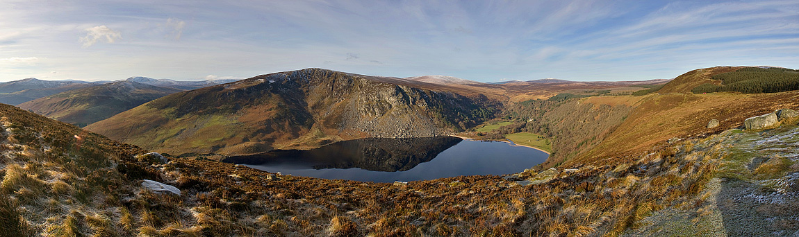
    Lough Tay is Small lake set between Djouce and Luggala in the Wicklow Mountains, southwest of Bray. Research access, facilities, and seasonal conditions with official sources before visiting.

    View place Lough Tay, about 15 km (9 mi) from Bray

    Image credit: Image: Tszabon / Wikimedia Commons, CC BY-SA 3.0

  • Verified Wikimedia Commons image of Sandymount Strand
    BeachNearby

    Sandymount Strand

    Straight-line distance
    about 15 km (9 mi)
    Recorded type
    beach

    Sandymount Strand is a beach reachable from Bray as a nearby nature destination. Research access, facilities, and seasonal conditions with official sources before visiting.

    View place Sandymount Strand, about 15 km (9 mi) from Bray

    Image credit: Image: Sarah777 at en.wikipedia / Wikimedia Commons, Public Domain

  • Verified Wikimedia Commons image of Velvet Strand
    BeachNearby

    Velvet Strand

    Straight-line distance
    about 25 km (15 mi)
    Recorded type
    beach

    Velvet Strand is a beach reachable from Bray as a nearby nature destination. Research access, facilities, and seasonal conditions with official sources before visiting.

    View place Velvet Strand, about 25 km (15 mi) from Bray

    Image credit: Image: Gpwitteveen / Wikimedia Commons, CC BY-SA 3.0

  • Verified Wikimedia Commons image of Lower Lake
    LakeNearby

    Lower Lake

    Straight-line distance
    about 27 km (16 mi)
    Recorded type
    lagoon

    Lower Lake is a lagoon reachable from Bray as a nearby nature destination. Research access, facilities, and seasonal conditions with official sources before visiting.

    View place Lower Lake, about 27 km (16 mi) from Bray

    Image credit: Image: Murcotipton / Wikimedia Commons, CC BY-SA 4.0

  • Verified Wikimedia Commons image of Wicklow Head
    CoastNearby

    Wicklow Head

    Straight-line distance
    about 28 km (17 mi)
    Recorded type
    headland

    Wicklow Head is a headland reachable from Bray as a nearby nature destination. Research access, facilities, and seasonal conditions with official sources before visiting.

    View place Wicklow Head, about 28 km (17 mi) from Bray

    Image credit: Image: David Quinn / Wikimedia Commons, CC BY-SA 2.0

  • Verified Wikimedia Commons image of Poulaphouca
    WaterfallNearby

    Poulaphouca

    Straight-line distance
    about 33 km (21 mi)
    Recorded type
    waterfall

    Poulaphouca is a waterfall reachable from Bray as a nearby nature destination. Research access, facilities, and seasonal conditions with official sources before visiting.

    View place Poulaphouca, about 33 km (21 mi) from Bray

    Image credit: Image: Robert Linsdell from St. Andrews, Canada / Wikimedia Commons, CC BY 2.0

  • Verified Wikimedia Commons image of Ballykeeffe Wood
    ForestDay-trip distance

    Ballykeeffe Wood

    Straight-line distance
    about 108 km (67 mi)
    Recorded type
    forest

    Ballykeeffe Wood is a forest reachable from Bray as a nearby nature destination. Research access, facilities, and seasonal conditions with official sources before visiting.

    View place Ballykeeffe Wood, about 108 km (67 mi) from Bray

    Image credit: Image: Antiqueight / Wikimedia Commons, CC BY-SA 4.0