Global CityIntelligence

Verified Wikimedia Commons image of San Leone
San Leoneabout 7 km (4 mi) from Agrigento. Image credit: Image: Toni Pecoraro / Wikimedia Commons, Public Domain

Nature discovery

Nature Near Agrigento, Italy

Research 15 classified outdoor destinations within weekend reach of Agrigento, grouped across 8 kinds of place and ordered by measured straight-line distance from the city centre. Distances only — no travel times, schedules, or rankings.

Places listed
15
Closest
San Leone — about 7 km
Furthest listed
about 118 km
Last updated
2026-05-16
Data year
2025

How this list is built

Each place is classified from its own Wikidata type, not from its name, and is ordered by measured straight-line distance from the centre of Agrigento. Distances are great-circle kilometres between two published coordinates — this page does not publish travel times, transport schedules, opening hours, ticket prices, or rankings. Confirm access, facilities, and seasonal conditions with an official source before travelling.

How far these are

Reachability is a second axis over the same places: the category says what a destination is, the band says how far it sits from Agrigento. Distances are measured in a straight line — this page publishes no travel times.

  • 7nearby
  • 8day-trip distance

What is out there

  • 5forests
  • 3beaches
  • 2coast and headlands
  • 2lakes
  • 2mountains
  • 2protected areas
  • 2parks
  • 1river

15 places near Agrigento

Ordered by straight-line distance from Agrigento, closest first. Distance bands: nearby is up to 60 km, day-trip distance is up to 120 km.

Places near Agrigento

Showing all 15 places.

  • Verified Wikimedia Commons image of San Leone
    BeachNearby

    San Leone

    Straight-line distance
    about 7 km (4 mi)
    Recorded type
    beach

    San Leone is a beach reachable from Agrigento as a nearby nature destination. Research access, facilities, and seasonal conditions with official sources before visiting.

    View place San Leone, about 7 km (4 mi) from Agrigento

    Image credit: Image: Toni Pecoraro / Wikimedia Commons, Public Domain

  • Verified Wikimedia Commons image of Scala dei Turchi
    CoastNearby

    Scala dei Turchi

    Straight-line distance
    about 10 km (6 mi)
    Recorded type
    cape

    Scala dei Turchi is White marl sea cliff and rock terraces on the Mediterranean coast at Realmonte, nearby west of Agrigento, flanked by sandy beaches. Research access, facilities, and seasonal conditions with official sources before visiting.

    View place Scala dei Turchi, about 10 km (6 mi) from Agrigento

    Image credit: Image: Carnby / Wikimedia Commons, CC BY 3.0

  • Verified Wikimedia Commons image of Capo Bianco
    CoastNearby

    Capo Bianco

    Straight-line distance
    about 28 km (18 mi)
    Recorded type
    cape

    Capo Bianco is a cape reachable from Agrigento as a nearby nature destination. Research access, facilities, and seasonal conditions with official sources before visiting.

    View place Capo Bianco, about 28 km (18 mi) from Agrigento

    Image credit: Image: Kalima / Wikimedia Commons, CC BY-SA 3.0

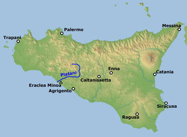
  • Verified Wikimedia Commons image of Platani River
    RiverNearby

    Platani River

    Straight-line distance
    about 29 km (18 mi)
    Recorded type
    river

    Platani River is River and valley flowing to a coastal reserve at its mouth (Capo Bianco) west of Agrigento, draining the Sicani Mountains. Research access, facilities, and seasonal conditions with official sources before visiting.

    View place Platani River, about 29 km (18 mi) from Agrigento

    Image credit: Image: Bjs / Wikimedia Commons, CC BY-SA 2.5

  • Verified Wikimedia Commons image of Lago Arancio
    LakeNearby

    Lago Arancio

    Straight-line distance
    about 58 km (36 mi)
    Recorded type
    reservoir

    Lago Arancio is Reservoir on the Carboj river near Sambuca di Sicilia in the Sicani Mountains, nearby northwest of Agrigento; a bird sanctuary. Research access, facilities, and seasonal conditions with official sources before visiting.

    View place Lago Arancio, about 58 km (36 mi) from Agrigento

    Image credit: Image: Giuseppe Tucci / Wikimedia Commons, CC BY-SA 3.0

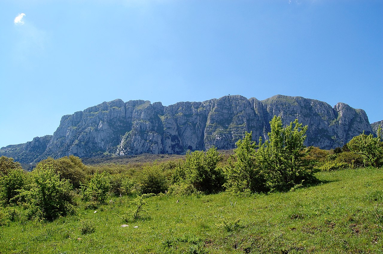
  • Verified Wikimedia Commons image of Rocca Busambra
    MountainDay-trip distance

    Rocca Busambra

    Straight-line distance
    about 63 km (39 mi)
    Recorded type
    mountain

    Rocca Busambra is limestone ridge, highest peak of the Sicani Mountains, above the Ficuzza woodland north of Agrigento toward Palermo. Research access, facilities, and seasonal conditions with official sources before visiting.

    View place Rocca Busambra, about 63 km (39 mi) from Agrigento

    Image credit: Image: tato grasso / Wikimedia Commons, CC BY-SA 3.0

  • Verified Wikimedia Commons image of Sicani Mountains
    MountainDay-trip distance

    Sicani Mountains

    Straight-line distance
    about 67 km (42 mi)
    Recorded type
    mountain range

    Sicani Mountains is Mountain range of central-southern Sicily spanning the provinces of Agrigento and Palermo, north and northwest of Agrigento. Research access, facilities, and seasonal conditions with official sources before visiting.

    View place Sicani Mountains, about 67 km (42 mi) from Agrigento

    Image credit: Image: Bjs / Wikimedia Commons, CC BY-SA 2.5

  • Verified Wikimedia Commons image of Pergusa Lake
    LakeDay-trip distance

    Pergusa Lake

    Straight-line distance
    about 68 km (42 mi)
    Recorded type
    lake

    Pergusa Lake is The only natural lake in Sicily, a brackish lake and nature reserve near Enna in the Erean Mountains, nearby northeast of Agrigento. Research access, facilities, and seasonal conditions with official sources before visiting.

    View place Pergusa Lake, about 68 km (42 mi) from Agrigento

    Image credit: Image: Massimiliano Canale (User:Max Canal / Wikimedia Commons, CC BY 2.5

  • Verified Wikimedia Commons image of Bosco Sacro
    ForestDay-trip distance

    Bosco Sacro

    Straight-line distance
    about 118 km (74 mi)
    Recorded type
    forest

    Bosco Sacro is a grove reachable from Agrigento as a nearby nature destination. Research access, facilities, and seasonal conditions with official sources before visiting.

    View place Bosco Sacro, about 118 km (74 mi) from Agrigento

    Image credit: Image: Krzysztof Popławski / Wikimedia Commons, CC BY 4.0