Supported cities
20
City profiles indexed for Iran.
Western Asia
Iran's profile spans high-altitude plateaus, arid basins, and dense historic cities, useful for users comparing West-Asian city contexts, climate exposure, and relocation factors. Iran is indexed at the country level in Western Asia, with 20 city profiles linked below.
Country profile
Iran
Verified image pending
Snapshot of structured Iran city intelligence and which verified utility layers are available on this hub.
Supported cities
20
City profiles indexed for Iran.
Emergency profile
Fallback
Verified emergency data is not available; fallback context is shown.
Healthcare profile
Fallback
Verified healthcare data is not available; fallback context is shown.
Transport profile
Fallback
Verified transport data is not available; fallback context is shown.
Related comparisons
0
Curated city-vs-city comparison pages that reference this country.
Related collections
0
Best Cities collections that include at least one city from this country.
Data year
2025
Reference year for the country intelligence dataset.
Last updated
2026-05-16
Most recent platform-side review of the country hub.
West Asia plateau
Plateau and basin geography with pronounced continental and arid climate zones.
Heat and water
Water-resource stress and summer heat are central adaptation priorities.
Moderate
International datasets provide a workable basis for neutral city comparison.
Country pages group cities into crawlable clusters and give national context without replacing city-level comparisons.
| Metric | Value | Context |
|---|---|---|
| Region | Western Asia | Used for geographic clustering and regional comparisons. |
| Indexed cities | 20 | Tehran, Isfahan, Tabriz, Mashhad, Shiraz, Qom, Karaj, Ahvaz, Kermanshah, Yazd, Rasht, Urmia, Hamadan, Ardabil, Kerman, Nishapur, Arak, Zahedan, Qazvin, Sari |
| Regional context | West Asia plateau | Plateau and basin geography with pronounced continental and arid climate zones. |
| Climate exposure | Heat and water | Water-resource stress and summer heat are central adaptation priorities. |
| Data confidence | Moderate | International datasets provide a workable basis for neutral city comparison. |
Each linked city page includes its own metadata, data table, source block, module links, and any verified utility layers.

Image credit: Image: Amir Pashaei / Wikimedia Commons, CC BY-SA 4.0
Iran / Western Asia
Use the Tehran profile to compare affordability, livability, and economic indicators against other indexed cities in Iran and across Western Asia, and to explore nearby nature and weekend destinations.

Image credit: Image: Pedram forouzanfar / Wikimedia Commons, CC BY-SA 4.0
Iran / Western Asia
Use the Isfahan profile to compare affordability, livability, and economic indicators against other indexed cities in Iran and across Western Asia, and to explore nearby nature and weekend destinations.

Image credit: Image: Hoseinb007 / Wikimedia Commons, Public Domain
Iran / Western Asia
Use the Tabriz profile to compare affordability, livability, and economic indicators against other indexed cities in Iran and across Western Asia, and to explore nearby nature and weekend destinations.

Image credit: Image: Mohammad farzani1988 / Wikimedia Commons, CC BY-SA 4.0
Iran / Western Asia
Use the Mashhad profile to compare affordability, livability, and economic indicators against other indexed cities in Iran and across Western Asia, and to explore nearby nature and weekend destinations.

Image credit: Image: آرش (Arche) / Wikimedia Commons, CC BY-SA 3.0
Iran / Western Asia
Use the Shiraz profile to compare affordability, livability, and economic indicators against other indexed cities in Iran and across Western Asia, and to explore nearby nature and weekend destinations.

Image credit: Image: Mohammad mahdi P9432 / Wikimedia Commons, CC BY-SA 3.0
Iran / Western Asia
Use the Qom profile to compare affordability, livability, and economic indicators against other indexed cities in Iran and across Western Asia, and to explore nearby nature and weekend destinations.
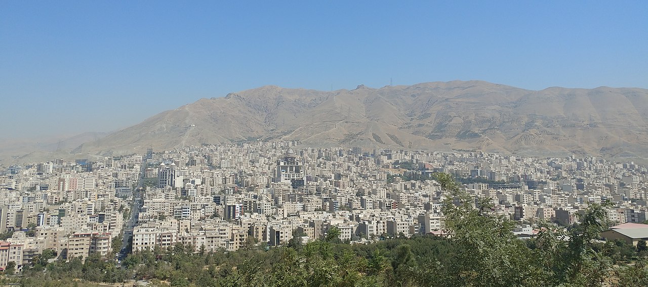
Image credit: Image: Civilaut / Wikimedia Commons, CC BY-SA 4.0
Iran / Western Asia
Use the Karaj profile to compare affordability, livability, and economic indicators against other indexed cities in Iran and across Western Asia, and to explore nearby nature and weekend destinations.

Image credit: Image: PayamAvarwand / Wikimedia Commons, CC0
Iran / Western Asia
Use the Ahvaz profile to compare affordability, livability, and economic indicators against other indexed cities in Iran and across Western Asia, and to explore nearby nature and weekend destinations.

Image credit: Image: Fars News Agency / Wikimedia Commons, CC BY 4.0
Iran / Western Asia
Use the Kermanshah profile to compare affordability, livability, and economic indicators against other indexed cities in Iran and across Western Asia, and to explore nearby nature and weekend destinations.

Image credit: Image: Julia Maudlin / Wikimedia Commons, CC BY 2.0
Iran / Western Asia
Use the Yazd profile to compare affordability, livability, and economic indicators against other indexed cities in Iran and across Western Asia, and to explore nearby nature and weekend destinations.

Image credit: Image: Mostafa Yekrangi / Wikimedia Commons, CC BY 2.0
Iran / Western Asia
Use the Rasht profile to compare affordability, livability, and economic indicators against other indexed cities in Iran and across Western Asia, and to explore nearby nature and weekend destinations.
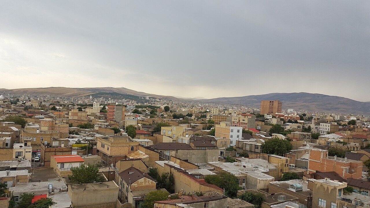
Image credit: Image: Anna-Freud / Wikimedia Commons, CC BY-SA 4.0
Iran / Western Asia
Use the Urmia profile to compare affordability, livability, and economic indicators against other indexed cities in Iran and across Western Asia, and to explore nearby nature and weekend destinations.

Image credit: Image: Alireza Javaheri / Wikimedia Commons, CC BY 3.0
Iran / Western Asia
Use the Hamadan profile to compare affordability, livability, and economic indicators against other indexed cities in Iran and across Western Asia, and to explore nearby nature and weekend destinations.

Image credit: Image: Ashena iran at Persian Wikipedia / Wikimedia Commons, Public Domain
Iran / Western Asia
Use the Ardabil profile to compare affordability, livability, and economic indicators against other indexed cities in Iran and across Western Asia, and to explore nearby nature and weekend destinations.

Image credit: Image: Betta27 / Wikimedia Commons, Public Domain
Iran / Western Asia
Use the Kerman profile to compare affordability, livability, and economic indicators against other indexed cities in Iran and across Western Asia, and to explore nearby nature and weekend destinations.

Image credit: Image: user:sonia sevilla / Wikimedia Commons, Public Domain
Iran / Western Asia
Use the Nishapur profile to compare affordability, livability, and economic indicators against other indexed cities in Iran and across Western Asia, and to explore nearby nature and weekend destinations.

Image credit: Image: Hamid Hajihusseini / Wikimedia Commons, CC BY 3.0
Iran / Western Asia
Use the Arak profile to compare affordability, livability, and economic indicators against other indexed cities in Iran and across Western Asia, and to explore nearby nature and weekend destinations.

Image credit: Image: Masoud Sheikh-Veisi / Wikimedia Commons, CC BY 4.0
Iran / Western Asia
Use the Zahedan profile to compare affordability, livability, and economic indicators against other indexed cities in Iran and across Western Asia, and to explore nearby nature and weekend destinations.

Image credit: Image: ak ba / Wikimedia Commons, CC BY-SA 3.0
Iran / Western Asia
Use the Qazvin profile to compare affordability, livability, and economic indicators against other indexed cities in Iran and across Western Asia, and to explore nearby nature and weekend destinations.

Image credit: Image: Ali tarighati / Wikimedia Commons, CC BY-SA 4.0
Iran / Western Asia
Use the Sari profile to compare affordability, livability, and economic indicators against other indexed cities in Iran and across Western Asia, and to explore nearby nature and weekend destinations.
Source-attributed country-level indicators for Iran will appear here once the platform integrates the relevant World Bank batch. The fallback below is intentional — the platform does not show placeholder numbers.
Country-level, not city-level
Indicators describe national context. Pair them with city profiles, comparisons, and verified utility layers (emergency, healthcare, transport) for local detail.
Source-attributed where available
Values come from the World Bank Development Indicators. Where no verified record exists, the platform shows a transparent fallback rather than a guessed number.
Different indicators, different years
Each record carries its own data year because publishers refresh indicators on their own cadence. The card and table both display the year alongside the value.
Context, not a ranking
Treat indicators as orientation, not as a leaderboard. The platform never claims any country is best, safest, cleanest, richest, healthiest, or most connected.
Read alongside city intelligence
Country indicators are most useful when combined with the city profiles in the country, the public-safety, healthcare, and transport sections, and the methodology and data-sources pages.
For full construction details, read the methodology page and the data sources registry.
The platform does not guess values. Source-attributed records for Iran will appear here once they are integrated from accepted publishers. In the meantime, review the city profiles in Iran, the public-safety, healthcare, and transport sections above, and the methodology and data-sources pages linked below.
| Indicator | Value | Unit | Data year | Status |
|---|---|---|---|---|
| Country indicators | Verified country indicator values are not yet published for this location. | |||
Global City Intelligence — country indicators dataset
Verified data unavailableVerified country indicators for this country are not yet integrated. Verified batches currently cover 25 supported countries across 9 World Bank Development Indicators (population, internet usage, urban-population share, GDP per capita, life expectancy, current health expenditure per capita, unemployment rate, CO₂ emissions per capita, fixed broadband subscriptions); additional batches will follow.
Country indicator values appear in this section only after they are sourced from accepted publishers and validated at build time. Malformed records cannot ship to production.
Verified emergency contacts for Iran, drawn from official emergency services and government publishers. Use these as a starting point and confirm current details with local authorities before traveling or relocating.
Methodology and the wider source registry are documented on the scoring methodology and data sources pages.
Verified national healthcare information for Iran, drawn from official government and public health publishers. This is informational only and does not provide medical advice.
Related sections: emergency and public safety, scoring methodology, and data sources.
Verified national transport context for Iran, attributed to official transport ministries, national operators, and aviation authorities. This is informational only; routes, fares, and schedules change frequently — check the linked authorities for current details.
Related sections: emergency and public safety, healthcare and hospitals, cities directory, countries directory, scoring methodology, data sources.
Curated city-vs-city comparisons that include at least one city from Iran. Each link opens a comparison page with structured indicators across cost, safety, healthcare, transport, and country context.
No curated city comparisons reference Iran yet. Browse the full city comparison directory for cross-country comparisons.
Curated city collections that include at least one Iran city. Each collection is a comparison-oriented shortlist, not an official ranking.
No curated city collections currently reference Iran cities. Browse the Best Cities collections index for related shortlists.
Explore rankings where supported Iran city profiles appear. Use rankings as directional city intelligence, not an official government ranking.
Ranking
A balanced ranking of cities across affordability, air quality, clean-energy readiness, and resilience.
20 cities from Iran appears in this ranking
Ranking
Cities that combine strong services, mobility, safety, clean air, and resilience into a healthy day-to-day profile.
20 cities from Iran appears in this ranking
Ranking
Cities that combine fast connectivity, safety, healthy day-to-day life, and a manageable cost-of-living balance for remote and hybrid workers.
20 cities from Iran appears in this ranking
Ranking
A health-oriented comparison of city air-quality scores using WHO-centered pollutant interpretation.
20 cities from Iran appears in this ranking
Ranking
Cities ranked by cost-of-living score, weighing housing pressure, essential spending, and household offsets across global metros.
20 cities from Iran appears in this ranking
Ranking
Cities ranked by internet speed, mobile coverage, and digital-readiness depth for residents, businesses, and remote workers.
20 cities from Iran appears in this ranking
Ranking
A ranking of city energy-transition readiness, grid resilience, clean-resource potential, and adaptation capacity.
20 cities from Iran appears in this ranking
Ranking
A practical affordability ranking that weighs housing pressure against transport access, services, and opportunity density.
20 cities from Iran appears in this ranking
See the full rankings directory for every available structured ranking.
Across 20 indexed cities, Ardabil leads at 62/100 and Mashhad sits at 55/100. Use the country page as a parent context layer; module-level detail lives on each city profile. Data year 2025; last updated 2026-05-16. Drawn from 3 institutional references.
Structured indicators on this hub are directional and intended for orientation. Verified utility layers — emergency, healthcare, transport — are attributed to official publishers where available and use transparent fallback states where verified country-level data is not yet integrated.
Structured indicators on this page are directional and intended for orientation. Verified datasets are being integrated; official sources should be used for critical decisions.
3 institutional references inform this view, listed below with reliability notes. Structured indicators on this page are directional and intended for orientation; verified datasets are being integrated and official sources should be used for critical decisions.
Used as a policy and methodology reference for urban exposure and resilience signals.
Used as an energy-resource and weather-normalization reference.
Used to explain urban climate vulnerability and adaptation scoring logic.