Global CityIntelligence

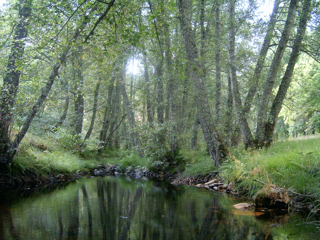
Verified Wikimedia Commons image of Alvão Natural Park
Alvão Natural Parkabout 10 km (6 mi) from Vila Real. Image credit: Image: Husond / Wikimedia Commons, CC BY-SA 3.0

Nature discovery

Nature Near Vila Real, Portugal

Research 12 classified outdoor destinations within weekend reach of Vila Real, grouped across 6 kinds of place and ordered by measured straight-line distance from the city centre. Distances only — no travel times, schedules, or rankings.

Places listed
12
Closest
Alvão Natural Park — about 10 km
Furthest listed
about 100 km
Last updated
2026-05-16
Data year
2025

How this list is built

Each place is classified from its own Wikidata type, not from its name, and is ordered by measured straight-line distance from the centre of Vila Real. Distances are great-circle kilometres between two published coordinates — this page does not publish travel times, transport schedules, opening hours, ticket prices, or rankings. Confirm access, facilities, and seasonal conditions with an official source before travelling.

How far these are

Reachability is a second axis over the same places: the category says what a destination is, the band says how far it sits from Vila Real. Distances are measured in a straight line — this page publishes no travel times.

  • 5nearby
  • 7day-trip distance

What is out there

  • 5waterfalls
  • 4protected areas
  • 3parks
  • 2rivers
  • 1mountain
  • 1national park

12 places near Vila Real

Ordered by straight-line distance from Vila Real, closest first. Distance bands: nearby is up to 60 km, day-trip distance is up to 120 km.

Places near Vila Real

Showing all 12 places.

  • Verified Wikimedia Commons image of Alvão Natural Park
    Protected areaNearby

    Alvão Natural Park

    Straight-line distance
    about 10 km (6 mi)
    Recorded type
    protected area

    Alvão Natural Park is Protected mountain area with the Fisgas de Ermelo waterfalls and heath, partly within Vila Real municipality, immediately west/northwest of the city. Research access, facilities, and seasonal conditions with official sources before visiting.

    View place Alvão Natural Park, about 10 km (6 mi) from Vila Real

    Image credit: Image: Husond / Wikimedia Commons, CC BY-SA 3.0

  • Verified Wikimedia Commons image of Serra do Marão
    MountainNearby

    Serra do Marão

    Straight-line distance
    about 13 km (8 mi)
    Recorded type
    mountain chain

    Serra do Marão is Mountain range reaching about on the Vila Real (Trás-os-Montes) and Porto district border, just west of Vila Real. Research access, facilities, and seasonal conditions with official sources before visiting.

    View place Serra do Marão, about 13 km (8 mi) from Vila Real

    Image credit: Image: Henrique Matos / Wikimedia Commons, CC BY 2.5

  • Verified Wikimedia Commons image of Tua River
    RiverNearby

    Tua River

    Straight-line distance
    about 28 km (17 mi)
    Recorded type
    river

    Tua River is Douro tributary running through a steep valley along the Vila Real and Bragança district border, nearby east of Vila Real. Research access, facilities, and seasonal conditions with official sources before visiting.

    View place Tua River, about 28 km (17 mi) from Vila Real

    Image credit: Image: The original uploader was Husond at English Wikipedia. / Wikimedia Commons, CC BY-SA 3.0

  • Verified Wikimedia Commons image of Arado Waterfall
    WaterfallNearby

    Arado Waterfall

    Straight-line distance
    about 57 km (35 mi)
    Recorded type
    waterfall

    Arado Waterfall is a waterfall reachable from Vila Real as a nearby nature destination. Research access, facilities, and seasonal conditions with official sources before visiting.

    View place Arado Waterfall, about 57 km (35 mi) from Vila Real

    Image credit: Image: Município de Terras de Bouro / Wikimedia Commons, CC BY-SA 3.0

  • Verified Wikimedia Commons image of Laja Waterfall
    WaterfallDay-trip distance

    Laja Waterfall

    Straight-line distance
    about 61 km (38 mi)
    Recorded type
    waterfall

    Laja Waterfall is a waterfall reachable from Vila Real as a nearby nature destination. Research access, facilities, and seasonal conditions with official sources before visiting.

    View place Laja Waterfall, about 61 km (38 mi) from Vila Real

    Image credit: Image: Joseolgon / Wikimedia Commons, CC BY 4.0

  • Verified Wikimedia Commons image of Leonte Waterfall
    WaterfallDay-trip distance

    Leonte Waterfall

    Straight-line distance
    about 61 km (38 mi)
    Recorded type
    waterfall

    Leonte Waterfall is a waterfall reachable from Vila Real as a nearby nature destination. Research access, facilities, and seasonal conditions with official sources before visiting.

    View place Leonte Waterfall, about 61 km (38 mi) from Vila Real

    Image credit: Image: Daniel Costa / Wikimedia Commons, CC BY-SA 4.0

  • Verified Wikimedia Commons image of Peneda-Gerês National Park
    National parkDay-trip distance

    Peneda-Gerês National Park

    Straight-line distance
    about 72 km (45 mi)
    Recorded type
    national park

    Peneda-Gerês National Park is Portugal's only national park, granite mountains, glacial valleys and reservoirs, about 90-nearby northwest of Vila Real. Research access, facilities, and seasonal conditions with official sources before visiting.

    View place Peneda-Gerês National Park, about 72 km (45 mi) from Vila Real

    Image credit: Image: Rosino / Wikimedia Commons, CC BY-SA 2.0

  • Verified Wikimedia Commons image of Douro International Natural Park
    Protected areaDay-trip distance

    Douro International Natural Park

    Straight-line distance
    about 85 km (53 mi)
    Recorded type
    protected area

    Douro International Natural Park is Nature park protecting the Douro canyon along the Portugal-Spain border, nearby east of Vila Real. Research access, facilities, and seasonal conditions with official sources before visiting.

    View place Douro International Natural Park, about 85 km (53 mi) from Vila Real

    Image credit: Image: Gerry Labrijn from London, UK / Wikimedia Commons, CC BY-SA 2.0

  • Verified Wikimedia Commons image of Tâmega River
    RiverDay-trip distance

    Tâmega River

    Straight-line distance
    about 94 km (58 mi)
    Recorded type
    river

    Tâmega River is Douro tributary flowing south from Galicia through the Vila Real district past Chaves and Amarante, west and north of Vila Real. Research access, facilities, and seasonal conditions with official sources before visiting.

    View place Tâmega River, about 94 km (58 mi) from Vila Real

    Image credit: Image: Joseolgon / Wikimedia Commons, CC BY-SA 4.0