Global CityIntelligence

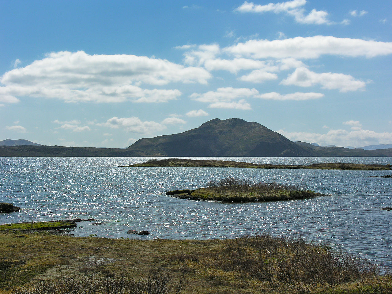
Verified Wikimedia Commons image of Skerjafjörður
Skerjafjörðurabout 4 km (2 mi) from Reykjavik. Image credit: Image: Christian Bickel fingalo / Wikimedia Commons, CC BY-SA 2.0

Nature discovery

Nature Near Reykjavik, Iceland

Research 16 classified outdoor destinations within weekend reach of Reykjavik, grouped across 7 kinds of place and ordered by measured straight-line distance from the city centre. Distances only — no travel times, schedules, or rankings.

Places listed
16
Closest
Skerjafjörður — about 4 km
Furthest listed
about 41 km
Last updated
2026-05-16
Data year
2025

How this list is built

Each place is classified from its own Wikidata type, not from its name, and is ordered by measured straight-line distance from the centre of Reykjavik. Distances are great-circle kilometres between two published coordinates — this page does not publish travel times, transport schedules, opening hours, ticket prices, or rankings. Confirm access, facilities, and seasonal conditions with an official source before travelling.

How far these are

Reachability is a second axis over the same places: the category says what a destination is, the band says how far it sits from Reykjavik. Distances are measured in a straight line — this page publishes no travel times.

  • 16nearby

What is out there

  • 6coast and headlands
  • 5waterfalls
  • 2lakes
  • 1forest
  • 1mountain
  • 1national park
  • 1protected area

16 places near Reykjavik

Ordered by straight-line distance from Reykjavik, closest first. Distance bands: nearby is up to 60 km.

Places near Reykjavik

Showing all 16 places.

  • Verified Wikimedia Commons image of Skerjafjörður
    CoastNearby

    Skerjafjörður

    Straight-line distance
    about 4 km (2 mi)
    Recorded type
    fjord

    Skerjafjörður is a fjord reachable from Reykjavik as a nearby nature destination. Research access, facilities, and seasonal conditions with official sources before visiting.

    View place Skerjafjörður, about 4 km (2 mi) from Reykjavik

    Image credit: Image: Christian Bickel fingalo / Wikimedia Commons, CC BY-SA 2.0

  • Verified Wikimedia Commons image of Kollafjörður
    CoastNearby

    Kollafjörður

    Straight-line distance
    about 6 km (4 mi)
    Recorded type
    fjord

    Kollafjörður is a fjord reachable from Reykjavik as a nearby nature destination. Research access, facilities, and seasonal conditions with official sources before visiting.

    View place Kollafjörður, about 6 km (4 mi) from Reykjavik

    Image credit: Image: Schnee ( talk ) / Wikimedia Commons, CC BY-SA 3.0

  • Verified Wikimedia Commons image of Tungufoss
    WaterfallNearby

    Tungufoss

    Straight-line distance
    about 12 km (7 mi)
    Recorded type
    waterfall

    Tungufoss is a waterfall reachable from Reykjavik as a nearby nature destination. Research access, facilities, and seasonal conditions with official sources before visiting.

    View place Tungufoss, about 12 km (7 mi) from Reykjavik

    Image credit: Image: Bromr / Wikimedia Commons, CC BY-SA 4.0

  • Verified Wikimedia Commons image of Heidmork
    ForestNearby

    Heidmork

    Straight-line distance
    about 12 km (8 mi)
    Recorded type
    forest

    Heidmork is Forested municipal conservation area and nature reserve nearby southeast of central Reykjavik, around Ellidavatn. Research access, facilities, and seasonal conditions with official sources before visiting.

    View place Heidmork, about 12 km (8 mi) from Reykjavik

    Image credit: Image: Roman Z / Wikimedia Commons, CC BY-SA 3.0

  • Verified Wikimedia Commons image of Álafoss
    WaterfallNearby

    Álafoss

    Straight-line distance
    about 13 km (8 mi)
    Recorded type
    waterfall

    Álafoss is a waterfall reachable from Reykjavik as a nearby nature destination. Research access, facilities, and seasonal conditions with official sources before visiting.

    View place Álafoss, about 13 km (8 mi) from Reykjavik

    Image credit: Image: Bromr / Wikimedia Commons, CC BY-SA 3.0

  • Verified Wikimedia Commons image of Hvalfjordur
    CoastNearby

    Hvalfjordur

    Straight-line distance
    about 18 km (11 mi)
    Recorded type
    fjord

    Hvalfjordur is Fjord with surrounding mountains and valleys along the coast north of Reykjavik. Research access, facilities, and seasonal conditions with official sources before visiting.

    View place Hvalfjordur, about 18 km (11 mi) from Reykjavik

    Image credit: Image: Hansueli Krapf / Wikimedia Commons, CC BY 3.0

  • Verified Wikimedia Commons image of Mount Esja
    MountainNearby

    Mount Esja

    Straight-line distance
    about 19 km (12 mi)
    Recorded type
    mountain

    Mount Esja is Volcanic basalt and tuff mountain range rising nearby north of Reykjavik across Kollafjordur bay. Research access, facilities, and seasonal conditions with official sources before visiting.

    View place Mount Esja, about 19 km (12 mi) from Reykjavik

    Image credit: Image: Axel Kristinsson from Reykjavík, Iceland / Wikimedia Commons, CC BY 2.0

  • Verified Wikimedia Commons image of Tröllafoss
    WaterfallNearby

    Tröllafoss

    Straight-line distance
    about 21 km (13 mi)
    Recorded type
    waterfall

    Tröllafoss is a waterfall reachable from Reykjavik as a nearby nature destination. Research access, facilities, and seasonal conditions with official sources before visiting.

    View place Tröllafoss, about 21 km (13 mi) from Reykjavik

    Image credit: Image: Bromr / Wikimedia Commons, CC BY-SA 3.0

  • Verified Wikimedia Commons image of Grundartangi
    CoastNearby

    Grundartangi

    Straight-line distance
    about 24 km (15 mi)
    Recorded type
    cape

    Grundartangi is a cape reachable from Reykjavik as a nearby nature destination. Research access, facilities, and seasonal conditions with official sources before visiting.

    View place Grundartangi, about 24 km (15 mi) from Reykjavik

    Image credit: Image: Steinninn / Wikimedia Commons, CC BY-SA 4.0

  • Verified Wikimedia Commons image of Lake Kleifarvatn
    LakeNearby

    Lake Kleifarvatn

    Straight-line distance
    about 25 km (15 mi)
    Recorded type
    lake

    Lake Kleifarvatn is Deep lake on the Mid-Atlantic fissure zone, the largest on the Reykjanes peninsula, nearby southwest of Reykjavik. Research access, facilities, and seasonal conditions with official sources before visiting.

    View place Lake Kleifarvatn, about 25 km (15 mi) from Reykjavik

    Image credit: Image: Joe deSousa / Wikimedia Commons, CC0

  • Verified Wikimedia Commons image of Laxfoss
    WaterfallNearby

    Laxfoss

    Straight-line distance
    about 27 km (17 mi)
    Recorded type
    waterfall

    Laxfoss is a waterfall reachable from Reykjavik as a nearby nature destination. Research access, facilities, and seasonal conditions with official sources before visiting.

    View place Laxfoss, about 27 km (17 mi) from Reykjavik

    Image credit: Image: Helgi Halldórsson from Reykjavík, Iceland / Wikimedia Commons, CC BY-SA 2.0

  • Verified Wikimedia Commons image of Pokafoss
    WaterfallNearby

    Pokafoss

    Straight-line distance
    about 29 km (18 mi)
    Recorded type
    waterfall

    Pokafoss is a waterfall reachable from Reykjavik as a nearby nature destination. Research access, facilities, and seasonal conditions with official sources before visiting.

    View place Pokafoss, about 29 km (18 mi) from Reykjavik

    Image credit: Image: Bromr / Wikimedia Commons, CC BY-SA 4.0

  • Verified Wikimedia Commons image of Borgarfjörður
    CoastNearby

    Borgarfjörður

    Straight-line distance
    about 39 km (24 mi)
    Recorded type
    fjord

    Borgarfjörður is a fjord reachable from Reykjavik as a nearby nature destination. Research access, facilities, and seasonal conditions with official sources before visiting.

    View place Borgarfjörður, about 39 km (24 mi) from Reykjavik

    Image credit: Image: Axel Kristinsson from Reykjavík, Iceland / Wikimedia Commons, CC BY 2.0

  • Verified Wikimedia Commons image of Lake Thingvallavatn
    LakeNearby

    Lake Thingvallavatn

    Straight-line distance
    about 39 km (24 mi)
    Recorded type
    lake

    Lake Thingvallavatn is Iceland's largest natural lake, a rift-valley lake within Thingvellir nearby east of Reykjavik. Research access, facilities, and seasonal conditions with official sources before visiting.

    View place Lake Thingvallavatn, about 39 km (24 mi) from Reykjavik

    Image credit: Image: Hansueli Krapf This file was uploaded with Commonist. / Wikimedia Commons, CC BY-SA 3.0