Global CityIntelligence

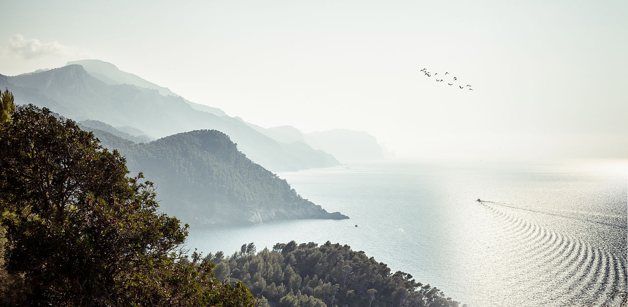
Verified Wikimedia Commons image of Dragonera
Dragoneraabout 28 km (18 mi) from Palma. Image credit: Image: Sir James / Wikimedia Commons, CC BY-SA 3.0

Nature discovery

Nature Near Palma, Spain

Research 8 classified outdoor destinations within weekend reach of Palma, grouped across 8 kinds of place and ordered by measured straight-line distance from the city centre. Distances only — no travel times, schedules, or rankings.

Places listed
8
Closest
Dragonera — about 28 km
Furthest listed
about 53 km
Last updated
2026-05-16
Data year
2025

How this list is built

Each place is classified from its own Wikidata type, not from its name, and is ordered by measured straight-line distance from the centre of Palma. Distances are great-circle kilometres between two published coordinates — this page does not publish travel times, transport schedules, opening hours, ticket prices, or rankings. Confirm access, facilities, and seasonal conditions with an official source before travelling.

How far these are

Reachability is a second axis over the same places: the category says what a destination is, the band says how far it sits from Palma. Distances are measured in a straight line — this page publishes no travel times.

  • 8nearby

What is out there

  • 3coast and headlands
  • 2beaches
  • 2islands
  • 2mountains
  • 2protected areas
  • 1lake
  • 1national park
  • 1park

8 places near Palma

Ordered by straight-line distance from Palma, closest first. Distance bands: nearby is up to 60 km.

Places near Palma

Showing all 8 places.

  • Verified Wikimedia Commons image of Dragonera
    IslandNearby

    Dragonera

    Straight-line distance
    about 28 km (18 mi)
    Recorded type
    Island

    Dragonera is Uninhabited islet and natural park off the western coast of Mallorca near Sant Elm, west of Palma. Research access, facilities, and seasonal conditions with official sources before visiting.

    View place Dragonera, about 28 km (18 mi) from Palma

    Image credit: Image: Sir James / Wikimedia Commons, CC BY-SA 3.0

  • Verified Wikimedia Commons image of Puig Major
    MountainNearby

    Puig Major

    Straight-line distance
    about 29 km (18 mi)
    Recorded type
    mountain

    Puig Major is Highest peak of Mallorca within the Serra de Tramuntana, in the municipality of Escorca north of Palma. Research access, facilities, and seasonal conditions with official sources before visiting.

    View place Puig Major, about 29 km (18 mi) from Palma

    Image credit: Image: Carlos Delgado editado por Xavigivax / Wikimedia Commons, CC BY-SA 3.0

  • Verified Wikimedia Commons image of Serra de Tramuntana
    MountainNearby

    Serra de Tramuntana

    Straight-line distance
    about 29 km (18 mi)
    Recorded type
    mountain chain

    Serra de Tramuntana is Limestone mountain range running along the northwest coast of Mallorca, northwest of Palma; a UNESCO cultural landscape. Research access, facilities, and seasonal conditions with official sources before visiting.

    View place Serra de Tramuntana, about 29 km (18 mi) from Palma

    Image credit: Image: Andrés Nieto Porras from Palma de Mallorca, España / Wikimedia Commons, CC BY-SA 2.0

  • Verified Wikimedia Commons image of Cala Tuent
    CoastNearby

    Cala Tuent

    Straight-line distance
    about 32 km (20 mi)
    Recorded type
    cove

    Cala Tuent is a cove reachable from Palma as a nearby nature destination. Research access, facilities, and seasonal conditions with official sources before visiting.

    View place Cala Tuent, about 32 km (20 mi) from Palma

    Image credit: Image: Olaf Tausch / Wikimedia Commons, CC BY 3.0

  • Verified Wikimedia Commons image of Es Trenc
    BeachNearby

    Es Trenc

    Straight-line distance
    about 38 km (24 mi)
    Recorded type
    Beach

    Es Trenc is Sand-dune beach and protected coastal area on the southern coast of Mallorca near Campos, south of Palma. Research access, facilities, and seasonal conditions with official sources before visiting.

    View place Es Trenc, about 38 km (24 mi) from Palma

    Image credit: Image: Andrés Nieto Porras from Palma de Mallorca, España / Wikimedia Commons, CC BY-SA 2.0

  • Verified Wikimedia Commons image of S'Albufera de Mallorca
    LakeNearby

    S'Albufera de Mallorca

    Straight-line distance
    about 47 km (29 mi)
    Recorded type
    estuarine lagoon

    S'Albufera de Mallorca is Largest wetland nature reserve of the Balearic Islands, on the northeast coast of Mallorca near Alcudia, northeast of Palma. Research access, facilities, and seasonal conditions with official sources before visiting.

    View place S'Albufera de Mallorca, about 47 km (29 mi) from Palma

    Image credit: Image: Olaf Tausch / Wikimedia Commons, CC BY 3.0

  • Verified Wikimedia Commons image of Cabrera Archipelago Maritime-Terrestrial National Park
    IslandNearby

    Cabrera Archipelago Maritime-Terrestrial National Park

    Straight-line distance
    about 53 km (33 mi)
    Recorded type
    archipelago

    Cabrera Archipelago Maritime-Terrestrial National Park is Protected island archipelago and marine national park in the sea off the south coast of Mallorca, south of Palma. Research access, facilities, and seasonal conditions with official sources before visiting.

    View place Cabrera Archipelago Maritime-Terrestrial National Park, about 53 km (33 mi) from Palma

    Image credit: Image: Olaf Tausch / Wikimedia Commons, CC BY 3.0