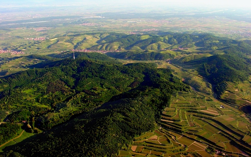
Research source-backed public places within weekend reach of Emmendingen. The records on this page are planning candidates — not a route planner, not a tourism ranking, not a live schedule, and not a price guide. Verify access, transport, weather, opening status, and seasonal conditions with the official source linked on each record before departure.
Cities and natural destinations already indexed on this site, grouped by measured straight-line distance from the city centre. Distances are geographic, not travel times — check routes and schedules with a transport operator before travelling.
Close to the city
Within 60 km of the city centre, measured in a straight line.
The nature layer groups these same records by what kind of outdoor place each one is — lakes, mountains, forests, beaches, protected areas — and orders them by measured straight-line distance from Emmendingen.
Start from your own city
This page helps users research nearby weekend places connected to Emmendingen, Germany, as a starting point for local-first weekend rest. It is not a route planner, ticket guide, events page, tourism ranking, or live availability source. Records are planning candidates only.
Records do not publish exact distances, travel times, transport schedules, opening hours, ticket prices, restaurant or hotel recommendations, attraction rankings, or live access status. Confirm time-sensitive details with the official park, museum, transport authority, or municipal source linked on each record.
Each card opens an official source where Wikidata lists one, plus links to the connected city, country profile, and the detail page for verified records. Records are unordered and not ranked; verify access and conditions with the official source before departure.
Black Forest is a forest reachable from Emmendingen as a nearby nature destination. Research access, facilities, and seasonal conditions with official sources before visiting.
Bühler Wald is a forest reachable from Emmendingen as a nearby nature destination. Research access, facilities, and seasonal conditions with official sources before visiting.
Feldberg is a mountain reachable from Emmendingen as a nearby nature destination. Research access, facilities, and seasonal conditions with official sources before visiting.
Feldsee-Wasserfall is a waterfall reachable from Emmendingen as a nearby nature destination. Research access, facilities, and seasonal conditions with official sources before visiting.
Hirschbach Falls is a waterfall reachable from Emmendingen as a nearby nature destination. Research access, facilities, and seasonal conditions with official sources before visiting.
Hornberg (Breisgau) is a mountain reachable from Emmendingen as a nearby nature destination. Research access, facilities, and seasonal conditions with official sources before visiting.
Kaiserstuhl is a mountain reachable from Emmendingen as a nearby nature destination. Research access, facilities, and seasonal conditions with official sources before visiting.
Kandel is a mountain reachable from Emmendingen as a nearby nature destination. Research access, facilities, and seasonal conditions with official sources before visiting.
Rammert is a forest reachable from Emmendingen as a nearby nature destination. Research access, facilities, and seasonal conditions with official sources before visiting.
Rosskopf is a mountain reachable from Emmendingen as a nearby nature destination. Research access, facilities, and seasonal conditions with official sources before visiting.
Schauinsland is a mountain reachable from Emmendingen as a nearby nature destination. Research access, facilities, and seasonal conditions with official sources before visiting.
Schönbuch is a forest reachable from Emmendingen as a nearby nature destination. Research access, facilities, and seasonal conditions with official sources before visiting.
Stöcklewald is a forest reachable from Emmendingen as a nearby nature destination. Research access, facilities, and seasonal conditions with official sources before visiting.
Todtnau Waterfall is a waterfall reachable from Emmendingen as a nearby nature destination. Research access, facilities, and seasonal conditions with official sources before visiting.
Totenkopf is a mountain reachable from Emmendingen as a nearby nature destination. Research access, facilities, and seasonal conditions with official sources before visiting.
Triberg Waterfalls is a waterfall reachable from Emmendingen as a nearby nature destination. Research access, facilities, and seasonal conditions with official sources before visiting.
Zweribachwasserfälle is a waterfall reachable from Emmendingen as a nearby nature destination. Research access, facilities, and seasonal conditions with official sources before visiting.
This page is a planning surface. Records do not publish exact distances, travel times, transport schedules, opening hours, ticket prices, restaurant or hotel recommendations, attraction rankings, or live access status.
Start with the Emmendingen city profile to anchor the location and country context.
Compare the nearby place records above against your origin city’s transport and access patterns.
Open the detail page for any record marked “Verified source record” to see the official source, Wikidata identity, and visual context.
Check the official source linked on each record for current opening, access, seasonal status, and conditions before departure.
Use the travel budget calculator for user-entered estimates — the platform does not publish ticket prices, transport schedules, or hotel/flight prices.
Confirm route, weather, opening/access status, and costs from official or trusted current sources before departure.
Verification status legend
The status shown on each card reflects the level of source verification: a matched Wikidata identity together with an official URL is shown as verified, an identity match without a confirmed official URL is shown as partially verified, and records not yet matched to a stable identifier are shown as pending review.
Verified source record
8
Partially verified source record
9
Sources and methodology
Nearby weekend places are sourced exclusively from Wikidata — primary identifier (QID), coordinates (P625), and official website (P856) — together with the linked operator (park authority, municipality, heritage body, or UNESCO official page) where Wikidata’s P856 points at it. Records do not publish fixed itineraries, attraction rankings, restaurant or hotel recommendations, event or festival dates, ticket prices, hotel or flight prices, opening hours, transport schedules, exact travel times, exact distances, weather forecasts, crime rates, or any “best” / “must-see” / “safest” / “cheapest” claims. Verify access, opening times, weather, health, and safety details with the official source linked on each record before departure. Read the scoring methodology for how structured indicators are constructed, and the data sources registry for the official publishers cited across the platform.
Continue exploring
Open related platform layers behind Emmendingen weekend research. Verify events, opening hours, transport, weather, health, and safety details with official or trusted current sources before departure.