Winterthur FAQ
Common questions about living in, visiting, working in, studying in and retiring to Winterthur, answered from the indexed cost-of-living, climate, safety, economy, education, healthcare and nearby-nature data on this profile.
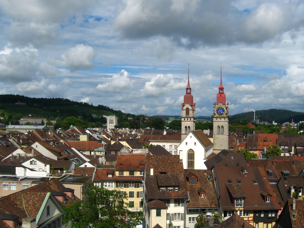
Is Winterthur worth visiting?
Winterthur has a very high quality-of-life estimate (88/100), with notable strengths in healthcare, public transport, green space, cleanliness and infrastructure. Visitors can also reach nature such as Rhine Falls, Irchel and Pfäffikersee within weekend range.
What is it like to live in Winterthur?
Winterthur has a very high quality-of-life estimate (88/100), with notable strengths in healthcare, public transport, green space, cleanliness and infrastructure. It indexes 88/100 for overall quality of life.
How much does it cost to live in Winterthur?
A single resident of Winterthur spends roughly CHF 2,530 per month, with a one-bedroom rent near CHF 1,350. Overall the city is relatively expensive for Switzerland. These are modelled estimates, not live quotes — verify locally.
What should I know about moving to Winterthur?
Plan for above-average living costs and check current rents before relocating. Winterthur is high for remote workers (78/100), based on connectivity, walkability, safety and overall livability and day-to-day amenities.
What is the job market like in Winterthur?
Winterthur's labour market is very strong, with opportunities concentrated in technology, tourism and hospitality and healthcare. Winterthur has a tourism-driven economy with strengths in tourism, hospitality and technology.
Is Winterthur good for digital nomads and remote work?
Winterthur offers strong infrastructure and amenities for remote professionals, with a remote-work score of 87/100.
What are the education options in Winterthur?
Winterthur is a regional education center with a mix of universities and research activity in our dataset, spanning fields such as Mathematics, Computer Science and Medicine.
Is Winterthur a good place to study?
Winterthur offers a moderate student environment, supported by walkable neighborhoods, strong quality of life and good connectivity.
What is healthcare like in Winterthur?
Winterthur has a regional healthcare center, supported by hospitals, specialist services, and public-health infrastructure, with a healthcare score of 73/100. Residents have strong access to healthcare across primary, specialist, and emergency care.
Is Winterthur a good place to retire?
Winterthur offers a combination of healthcare access, safety, and amenities that may appeal to retirees, with a retirement score of 68/100. Residents benefit from parks and green space, walkable streets and broad urban amenities and day-to-day services.
What is the climate like in Winterthur?
Winterthur has a humid continental climate, averaging about 9.9°C annually with roughly 1050 mm of rain. The hottest month is Jul and the coldest Jan. The driest is typically Jan.
Is Winterthur a safe place to live?
Winterthur ranks in the upper tier of our safety index (90/100), with strong personal-safety and low night-time indicators.
How easy is it to get around Winterthur?
Winterthur indexes a walkability score of 82 and a cycling score of 78 out of 100. Check the local operator for live transit routes and fares.
What nature and outdoor places are near Winterthur?
Nature destinations within about 170 km of Winterthur include Rhine Falls, Irchel and Pfäffikersee. Each is linked with its official source on the profile.
Is Winterthur good for families?
Winterthur scores very high for family living (87/100), helped by education access, safety, parks and green space and healthcare.
What outdoor activities are there around Winterthur?
Winterthur rates 48/100 for outdoor lifestyle and 90/100 for green space. Nearby nature such as Rhine Falls, Irchel and Pfäffikersee supports day hikes, water activities and weekend trips.