City
Toronto
Indexed city profile in Canada.
Visual guide
Explore source-attributed visual context for Toronto, Canada — verified hero imagery from the existing media catalog alongside city intelligence, neighborhood planning links, comparisons, and budgeting tools. Not a tourism guide, not an attractions ranking, and not official tourism information.
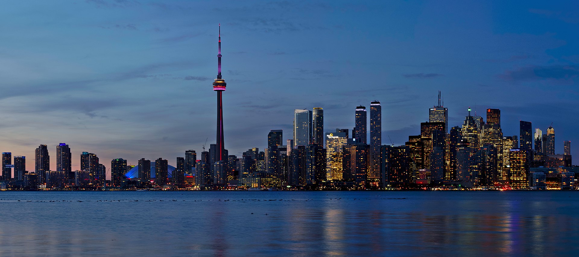
Image credit: Image: Jchmrt / Wikimedia Commons, CC BY-SA 4.0
Snapshot for orienting visually around Toronto. Cards link to the structured profile, country hub, and verified context layers behind the indicators. Imagery is orientation, not evidence.
City
Toronto
Indexed city profile in Canada.
Country hub
Canada
Open the country hub for verified emergency, healthcare, and transport-authority context where available.
Visual focus
Relocation visual context
Editorial framing for this visual guide. Images are orientation, not evidence — pair with structured context layers.
Verified imagery
Hero + 1 secondary
Imagery comes from the existing verified media catalog with source, author, and license metadata. Fallback cities render the designed fallback block instead.
Up to three additional verified images from the existing media catalog, each with source and license attribution. Use these as orientation only — they capture single moments and are not evidence of current conditions.

CN Tower
Image credit: Image: Chris Woodrich / Wikimedia Commons, CC BY-SA 4.0
How to read a city visually using the platform. Each prompt connects imagery to structured indicators and official sources — imagery is orientation, not evidence.
Urban form and density
Use verified imagery to orient around the city's general form, density, and street-level texture. Confirm any specific district or address with official local sources rather than reading exact facts from a single image.
Transport and arrival context
Hero and secondary imagery can hint at the city's mobility patterns. Confirm routes, fares, and schedules through the official local transport authority — this guide does not publish them.
Climate and seasonal context
Verified imagery captures a single moment. Use the city profile's climate framing and the country hub for seasonal expectations rather than inferring climate from one image.
Public realm and daily-life context
Imagery suggests how public space looks. Verify everyday details — safety, healthcare access, services — with the country emergency and healthcare profiles and official local sources.
Country and regional context
Open the country hub for verified emergency, healthcare, and transport-authority context alongside the visual guide. The hero image is orientation, not evidence.
Which platform-side context layers are available for the country and city behind the imagery. Where verified data is not on file, the platform shows a transparent fallback rather than fabricated information.
Transport context
Verified country-level transport-authority context is on file for Canada. Confirm routes, fares, and schedules through the official authorities cited on the country hub.
Open the city transport contextSafety context
Verified country-level emergency contact context is on file for Canada. Always confirm current numbers with the official local emergency service.
Open the country safety contextHealthcare context
Verified country-level healthcare access context is on file for Canada. Confirm registration, insurance, and access through official local sources.
Open the country healthcare contextOpen the related platform layers behind the visual orientation. Use city, country, arrival, neighborhood, and moving-to planning pages alongside the imagery.
City-vs-city comparisons that include Toronto. Use these alongside the visual orientation to weigh other cities you are considering.
Comparison
New York vs Toronto: Cost, Safety, Healthcare & Transport
Compare New York and Toronto across cost of living, air quality, safety, healthcare, transport, and country context for North American relocation and remote-work planning.
Comparison
Vancouver vs Toronto: Cost, Safety, Healthcare & Transport
Compare Vancouver and Toronto across cost of living, air quality, safety, healthcare, transport, and country context for Canadian intra-country relocation.
Comparison
Montreal vs Toronto: Cost, Safety, Healthcare & Transport
Compare Montreal and Toronto across cost framing, transport access, country-level healthcare and emergency context, and cultural depth.
Regional discovery collections that include Toronto — named natural regions grouping nearby places and cities for local-first day and weekend planning.
Theme-first discovery collections that include Toronto — grouped by outdoor interest.
What this page is and is not. Read this before treating any image as evidence.
This page is a visual orientation guide for Toronto, Canada. Imagery comes from the existing verified media catalog with source, author, and license attribution. It is not a tourism guide, not an attractions ranking, not an official tourism page, and not evidence of current local conditions. The page does not publish neighborhood names, district boundaries, rent or sale prices, crime rates, school rankings, hospital proximities, transit operators, commute times, or any “best” / “must-see” / “safest” / “cheapest” claims. For time-sensitive details, confirm with the official local source.
4 institutional references inform this view, listed below with reliability notes. Structured indicators on this page are directional and intended for orientation; verified datasets are being integrated and official sources should be used for critical decisions.
Used as a policy and methodology reference for urban exposure and resilience signals.
Used as an energy-resource and weather-normalization reference.
Used to explain urban climate vulnerability and adaptation scoring logic.
Used as the primary attribution for Canada's 911 universal emergency number.