Nearby Weekend Places from Gloucester, United Kingdom
Research source-backed public places within weekend reach of Gloucester. The records on this page are planning candidates — not a route planner, not a tourism ranking, not a live schedule, and not a price guide. Verify access, transport, weather, opening status, and seasonal conditions with the official source linked on each record before departure.
This page helps users research nearby weekend places connected to Gloucester, United Kingdom, as a starting point for local-first weekend rest. It is not a route planner, ticket guide, events page, tourism ranking, or live availability source. Records are planning candidates only.
Records do not publish exact distances, travel times, transport schedules, opening hours, ticket prices, restaurant or hotel recommendations, attraction rankings, or live access status. Confirm time-sensitive details with the official park, museum, transport authority, or municipal source linked on each record.
Each card opens an official source where Wikidata lists one, plus links to the connected city, country profile, and the detail page for verified records. Records are unordered and not ranked; verify access and conditions with the official source before departure.
Black Mountains is Mountain range on the England-Wales border within the Bannau Brycheiniog (Brecon Beacons) National Park, west/northwest of Gloucester. Research access, facilities, and seasonal conditions with official sources before visiting.
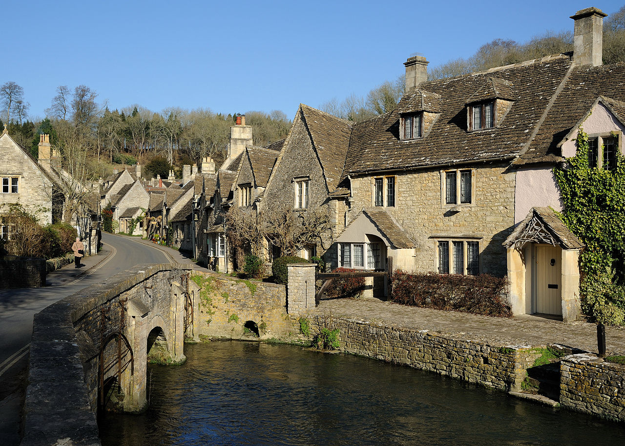
Cotswolds is Limestone hill range and protected National Landscape (AONB) to the east and southeast of Gloucester. Research access, facilities, and seasonal conditions with official sources before visiting.
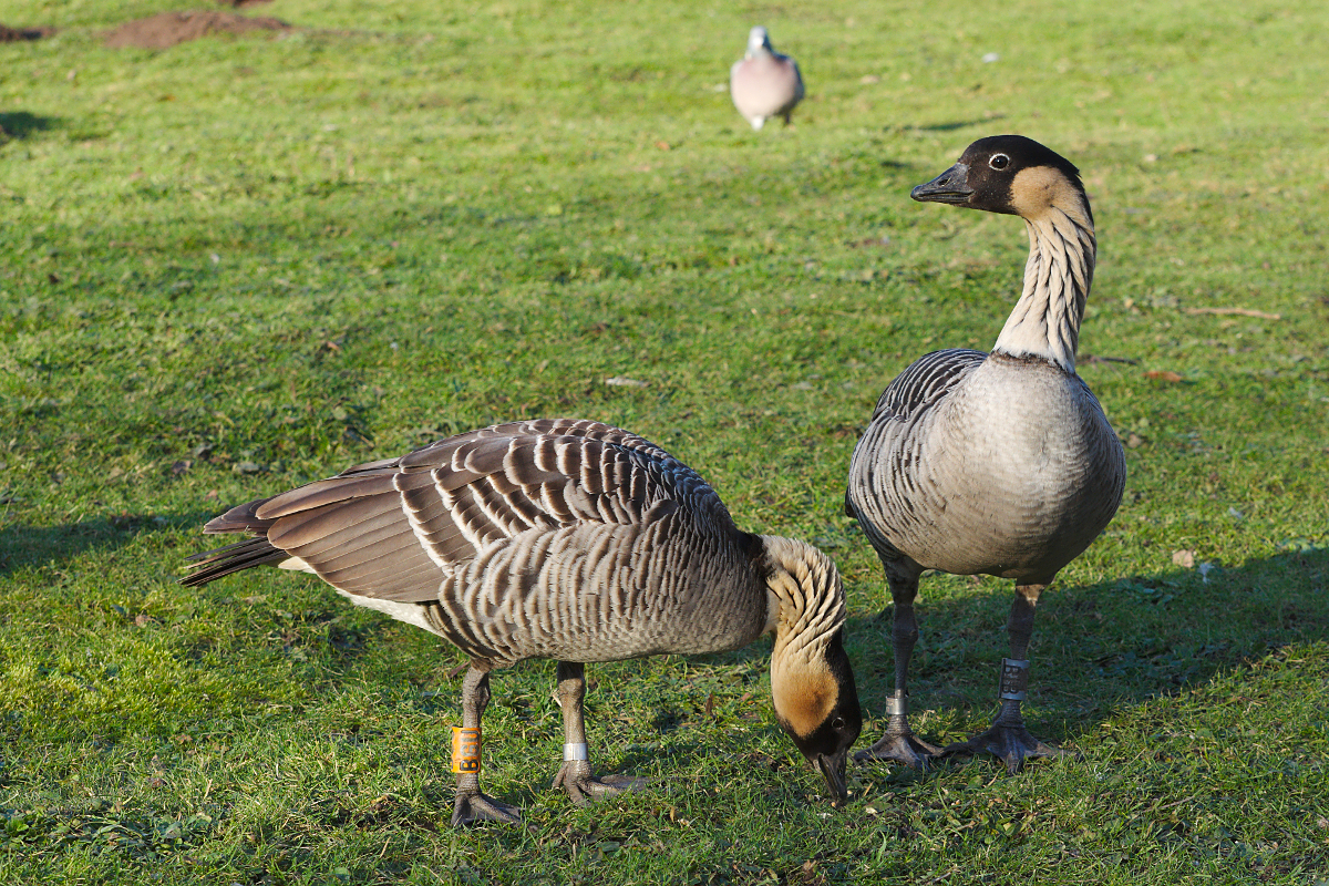
Image: The original uploader was Lemoncurd at English Wikipedia. / Wikimedia Commons, CC BY-SA 3.0. Visual context only.
United Kingdom · Western Europe
Forest of Dean
Nature area
Forest of Dean is Ancient woodland and former royal forest immediately west of Gloucester, between the Severn and Wye rivers. Research access, facilities, and seasonal conditions with official sources before visiting.
Malvern Hills is Range of hills forming a north-south ridge to the north of Gloucester on the Worcestershire-Herefordshire border. Research access, facilities, and seasonal conditions with official sources before visiting.
Severn Estuary is Tidal estuary of the River Severn flowing into the Bristol Channel, beginning near Gloucester and extending southwest. Research access, facilities, and seasonal conditions with official sources before visiting.
Symonds Yat is Rocky hilltop viewpoint and gorge on the River Wye, west of Gloucester in the Wye Valley. Research access, facilities, and seasonal conditions with official sources before visiting.
WWT Slimbridge is Wetland wildlife reserve on the eastern side of the Severn Estuary, southwest of Gloucester. Research access, facilities, and seasonal conditions with official sources before visiting.
Wye Valley is River valley and protected National Landscape along the River Wye, to the west and southwest of Gloucester on the Wales-England border. Research access, facilities, and seasonal conditions with official sources before visiting.
This page is a planning surface. Records do not publish exact distances, travel times, transport schedules, opening hours, ticket prices, restaurant or hotel recommendations, attraction rankings, or live access status.
Start with the Gloucester city profile to anchor the location and country context.
Compare the nearby place records above against your origin city’s transport and access patterns.
Open the detail page for any record marked “Verified source record” to see the official source, Wikidata identity, and visual context.
Check the official source linked on each record for current opening, access, seasonal status, and conditions before departure.
Use the travel budget calculator for user-entered estimates — the platform does not publish ticket prices, transport schedules, or hotel/flight prices.
Confirm route, weather, opening/access status, and costs from official or trusted current sources before departure.
Verification status legend
The status shown on each card reflects the level of source verification: a matched Wikidata identity together with an official URL is shown as verified, an identity match without a confirmed official URL is shown as partially verified, and records not yet matched to a stable identifier are shown as pending review.
Verified source record
2
Partially verified source record
6
Sources and methodology
Nearby weekend places are sourced exclusively from Wikidata — primary identifier (QID), coordinates (P625), and official website (P856) — together with the linked operator (park authority, municipality, heritage body, or UNESCO official page) where Wikidata’s P856 points at it. Records do not publish fixed itineraries, attraction rankings, restaurant or hotel recommendations, event or festival dates, ticket prices, hotel or flight prices, opening hours, transport schedules, exact travel times, exact distances, weather forecasts, crime rates, or any “best” / “must-see” / “safest” / “cheapest” claims. Verify access, opening times, weather, health, and safety details with the official source linked on each record before departure. Read the scoring methodology for how structured indicators are constructed, and the data sources registry for the official publishers cited across the platform.
Continue exploring
Open related platform layers behind Gloucester weekend research. Verify events, opening hours, transport, weather, health, and safety details with official or trusted current sources before departure.