Research source-backed public places within weekend reach of Cherbourg. The records on this page are planning candidates — not a route planner, not a tourism ranking, not a live schedule, and not a price guide. Verify access, transport, weather, opening status, and seasonal conditions with the official source linked on each record before departure.
This page helps users research nearby weekend places connected to Cherbourg, France, as a starting point for local-first weekend rest. It is not a route planner, ticket guide, events page, tourism ranking, or live availability source. Records are planning candidates only.
Records do not publish exact distances, travel times, transport schedules, opening hours, ticket prices, restaurant or hotel recommendations, attraction rankings, or live access status. Confirm time-sensitive details with the official park, museum, transport authority, or municipal source linked on each record.
Each card opens an official source where Wikidata lists one, plus links to the connected city, country profile, and the detail page for verified records. Records are unordered and not ranked; verify access and conditions with the official source before departure.
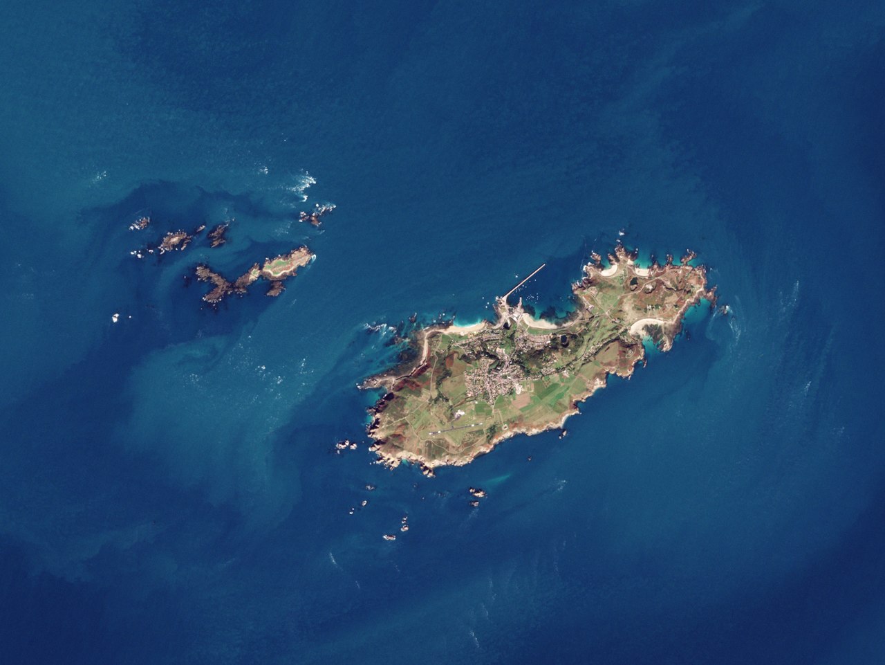
Alderney is Channel Island with cliffs, heathland and sandy bays, nearby northwest of Cherbourg across the water. Research access, facilities, and seasonal conditions with official sources before visiting.
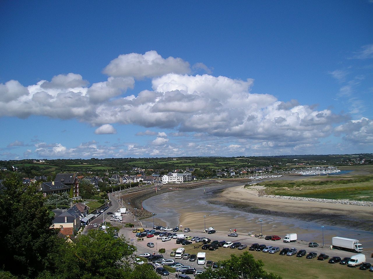
Cap de Carteret is Coastal cape with cliffs, heath and perched dunes on the west coast of the Cotentin, nearby southwest of Cherbourg. Research access, facilities, and seasonal conditions with official sources before visiting.
Cap de la Hague is Granite-and-gneiss cape with cliffs, coves and strong tidal currents at the northwest tip of the Cotentin Peninsula, nearby west of Cherbourg. Research access, facilities, and seasonal conditions with official sources before visiting.
Cerisy Forest is Beech woodland and national nature reserve straddling Manche and Calvados, nearby southeast of Cherbourg. Research access, facilities, and seasonal conditions with official sources before visiting.
Chausey is Granite archipelago of islands and islets with large tidal range off the Normandy coast near Granville, nearby south of Cherbourg. Research access, facilities, and seasonal conditions with official sources before visiting.
Mont Pinçon is Highest point of Calvados at with heathland in western Norman Switzerland, nearby southeast of Cherbourg. Research access, facilities, and seasonal conditions with official sources before visiting.
Nez de Jobourg is Rocky headland with sea cliffs reaching about on the northwest Cotentin coast, nearby west of Cherbourg. Research access, facilities, and seasonal conditions with official sources before visiting.
Image: Naval History & Heritage Command from Washington, DC, USA / Wikimedia Commons, CC BY 2.0. Visual context only.
France · Western Europe
Utah Beach
Beach
Utah Beach is Long sandy beach backed by dunes on the southeast Cotentin coast, nearby southeast of Cherbourg. Research access, facilities, and seasonal conditions with official sources before visiting.
This page is a planning surface. Records do not publish exact distances, travel times, transport schedules, opening hours, ticket prices, restaurant or hotel recommendations, attraction rankings, or live access status.
Start with the Cherbourg city profile to anchor the location and country context.
Compare the nearby place records above against your origin city’s transport and access patterns.
Open the detail page for any record marked “Verified source record” to see the official source, Wikidata identity, and visual context.
Check the official source linked on each record for current opening, access, seasonal status, and conditions before departure.
Use the travel budget calculator for user-entered estimates — the platform does not publish ticket prices, transport schedules, or hotel/flight prices.
Confirm route, weather, opening/access status, and costs from official or trusted current sources before departure.
Verification status legend
The status shown on each card reflects the level of source verification: a matched Wikidata identity together with an official URL is shown as verified, an identity match without a confirmed official URL is shown as partially verified, and records not yet matched to a stable identifier are shown as pending review.
Verified source record
3
Partially verified source record
5
Sources and methodology
Nearby weekend places are sourced exclusively from Wikidata — primary identifier (QID), coordinates (P625), and official website (P856) — together with the linked operator (park authority, municipality, heritage body, or UNESCO official page) where Wikidata’s P856 points at it. Records do not publish fixed itineraries, attraction rankings, restaurant or hotel recommendations, event or festival dates, ticket prices, hotel or flight prices, opening hours, transport schedules, exact travel times, exact distances, weather forecasts, crime rates, or any “best” / “must-see” / “safest” / “cheapest” claims. Verify access, opening times, weather, health, and safety details with the official source linked on each record before departure. Read the scoring methodology for how structured indicators are constructed, and the data sources registry for the official publishers cited across the platform.
Continue exploring
Open related platform layers behind Cherbourg weekend research. Verify events, opening hours, transport, weather, health, and safety details with official or trusted current sources before departure.