Research source-backed public places within weekend reach of Brindisi. The records on this page are planning candidates — not a route planner, not a tourism ranking, not a live schedule, and not a price guide. Verify access, transport, weather, opening status, and seasonal conditions with the official source linked on each record before departure.
This page helps users research nearby weekend places connected to Brindisi, Italy, as a starting point for local-first weekend rest. It is not a route planner, ticket guide, events page, tourism ranking, or live availability source. Records are planning candidates only.
Records do not publish exact distances, travel times, transport schedules, opening hours, ticket prices, restaurant or hotel recommendations, attraction rankings, or live access status. Confirm time-sensitive details with the official park, museum, transport authority, or municipal source linked on each record.
Each card opens an official source where Wikidata lists one, plus links to the connected city, country profile, and the detail page for verified records. Records are unordered and not ranked; verify access and conditions with the official source before departure.
Alta Murgia National Park is National park protecting grass-steppe habitat on the Murgia uplands, northwest of Brindisi in inland Apulia. Research access, facilities, and seasonal conditions with official sources before visiting.
Castellana Caves is Karst cave system with galleries and stalactites at Castellana Grotte, northwest of Brindisi in the Bari area. Research access, facilities, and seasonal conditions with official sources before visiting.
Gulf of Taranto is Ionian Sea gulf along the southwestern coast of the Salento and Taranto area, west of Brindisi. Research access, facilities, and seasonal conditions with official sources before visiting.
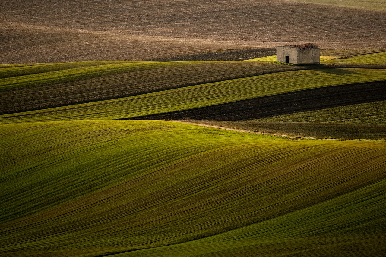
Itria Valley is Karst depression of olive groves and vineyards spanning the Brindisi, Taranto and Bari provinces, northwest of Brindisi. Research access, facilities, and seasonal conditions with official sources before visiting.
Le Cesine is Coastal wetland and WWF state nature reserve (Ramsar site) with ponds and dunes on the Adriatic coast south of Brindisi, near Lecce. Research access, facilities, and seasonal conditions with official sources before visiting.
Salento is Limestone peninsula forming the heel of Italy, with coastal and rural landscapes extending south of Brindisi. Research access, facilities, and seasonal conditions with official sources before visiting.
Santa Maria di Leuca is Promontory at the southeastern tip of the Salento peninsula where the Adriatic and Ionian seas meet, south of Brindisi. Research access, facilities, and seasonal conditions with official sources before visiting.
Strait of Otranto is Sea channel linking the Adriatic and Ionian seas along the eastern Salento coast, southeast of Brindisi. Research access, facilities, and seasonal conditions with official sources before visiting.
This page is a planning surface. Records do not publish exact distances, travel times, transport schedules, opening hours, ticket prices, restaurant or hotel recommendations, attraction rankings, or live access status.
Start with the Brindisi city profile to anchor the location and country context.
Compare the nearby place records above against your origin city’s transport and access patterns.
Open the detail page for any record marked “Verified source record” to see the official source, Wikidata identity, and visual context.
Check the official source linked on each record for current opening, access, seasonal status, and conditions before departure.
Use the travel budget calculator for user-entered estimates — the platform does not publish ticket prices, transport schedules, or hotel/flight prices.
Confirm route, weather, opening/access status, and costs from official or trusted current sources before departure.
Verification status legend
The status shown on each card reflects the level of source verification: a matched Wikidata identity together with an official URL is shown as verified, an identity match without a confirmed official URL is shown as partially verified, and records not yet matched to a stable identifier are shown as pending review.
Verified source record
3
Partially verified source record
5
Sources and methodology
Nearby weekend places are sourced exclusively from Wikidata — primary identifier (QID), coordinates (P625), and official website (P856) — together with the linked operator (park authority, municipality, heritage body, or UNESCO official page) where Wikidata’s P856 points at it. Records do not publish fixed itineraries, attraction rankings, restaurant or hotel recommendations, event or festival dates, ticket prices, hotel or flight prices, opening hours, transport schedules, exact travel times, exact distances, weather forecasts, crime rates, or any “best” / “must-see” / “safest” / “cheapest” claims. Verify access, opening times, weather, health, and safety details with the official source linked on each record before departure. Read the scoring methodology for how structured indicators are constructed, and the data sources registry for the official publishers cited across the platform.
Continue exploring
Open related platform layers behind Brindisi weekend research. Verify events, opening hours, transport, weather, health, and safety details with official or trusted current sources before departure.