Research source-backed public places within weekend reach of Uzhhorod. The records on this page are planning candidates — not a route planner, not a tourism ranking, not a live schedule, and not a price guide. Verify access, transport, weather, opening status, and seasonal conditions with the official source linked on each record before departure.
This page helps users research nearby weekend places connected to Uzhhorod, Ukraine, as a starting point for local-first weekend rest. It is not a route planner, ticket guide, events page, tourism ranking, or live availability source. Records are planning candidates only.
Records do not publish exact distances, travel times, transport schedules, opening hours, ticket prices, restaurant or hotel recommendations, attraction rankings, or live access status. Confirm time-sensitive details with the official park, museum, transport authority, or municipal source linked on each record.
Each card opens an official source where Wikidata lists one, plus links to the connected city, country profile, and the detail page for verified records. Records are unordered and not ranked; verify access and conditions with the official source before departure.
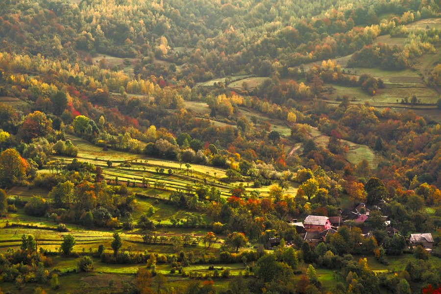
Carpathian Biosphere Reserve is UNESCO biosphere reserve of primeval beech forests and mountain massifs in the central and eastern Ukrainian Carpathians of Transcarpathia, southeast of Uzhhorod. Research access, facilities, and seasonal conditions with official sources before visiting.
Morske oko is Natural landslide-dammed lake in the Vihorlat Mountains of eastern Slovakia, roughly 50-nearby southwest of Uzhhorod across the border. Research access, facilities, and seasonal conditions with official sources before visiting.
Poloniny National Park is National park in the Bukovec Mountains of northeastern Slovakia at the Ukrainian and Polish borders, adjoining Uzh National Nature Park north of Uzhhorod. Research access, facilities, and seasonal conditions with official sources before visiting.
Uzh National Nature Park is National nature park in the Eastern Carpathians of the Uzh river valley, nearby north of Uzhhorod at the Slovak and Polish borders. Research access, facilities, and seasonal conditions with official sources before visiting.
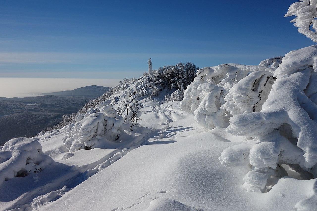
Vihorlat Mountains is Volcanic mountain range in eastern Slovakia and western Ukraine immediately west and southwest of Uzhhorod, highest peak Vihorlat at . Research access, facilities, and seasonal conditions with official sources before visiting.
Vihorlat Protected Landscape Area is Protected landscape area covering forested volcanic terrain in the Vihorlat Mountains of eastern Slovakia, about 40-nearby southwest of Uzhhorod. Research access, facilities, and seasonal conditions with official sources before visiting.
Voievodyn Waterfall is Waterfall on the Voievodyn river in Uzhhorod Raion, in the volcanic foothills roughly 30-nearby northeast of Uzhhorod. Research access, facilities, and seasonal conditions with official sources before visiting.
Zacharovanyi Krai National Nature Park is National nature park on volcanic slopes of the Vyhorlat-Hutyn ridge in Zakarpattia Oblast, about 70-nearby east of Uzhhorod. Research access, facilities, and seasonal conditions with official sources before visiting.
This page is a planning surface. Records do not publish exact distances, travel times, transport schedules, opening hours, ticket prices, restaurant or hotel recommendations, attraction rankings, or live access status.
Start with the Uzhhorod city profile to anchor the location and country context.
Compare the nearby place records above against your origin city’s transport and access patterns.
Open the detail page for any record marked “Verified source record” to see the official source, Wikidata identity, and visual context.
Check the official source linked on each record for current opening, access, seasonal status, and conditions before departure.
Use the travel budget calculator for user-entered estimates — the platform does not publish ticket prices, transport schedules, or hotel/flight prices.
Confirm route, weather, opening/access status, and costs from official or trusted current sources before departure.
Verification status legend
The status shown on each card reflects the level of source verification: a matched Wikidata identity together with an official URL is shown as verified, an identity match without a confirmed official URL is shown as partially verified, and records not yet matched to a stable identifier are shown as pending review.
Verified source record
4
Partially verified source record
4
Sources and methodology
Nearby weekend places are sourced exclusively from Wikidata — primary identifier (QID), coordinates (P625), and official website (P856) — together with the linked operator (park authority, municipality, heritage body, or UNESCO official page) where Wikidata’s P856 points at it. Records do not publish fixed itineraries, attraction rankings, restaurant or hotel recommendations, event or festival dates, ticket prices, hotel or flight prices, opening hours, transport schedules, exact travel times, exact distances, weather forecasts, crime rates, or any “best” / “must-see” / “safest” / “cheapest” claims. Verify access, opening times, weather, health, and safety details with the official source linked on each record before departure. Read the scoring methodology for how structured indicators are constructed, and the data sources registry for the official publishers cited across the platform.
Continue exploring
Open related platform layers behind Uzhhorod weekend research. Verify events, opening hours, transport, weather, health, and safety details with official or trusted current sources before departure.