Research source-backed public places within weekend reach of Koblenz. The records on this page are planning candidates — not a route planner, not a tourism ranking, not a live schedule, and not a price guide. Verify access, transport, weather, opening status, and seasonal conditions with the official source linked on each record before departure.
This page helps users research nearby weekend places connected to Koblenz, Germany, as a starting point for local-first weekend rest. It is not a route planner, ticket guide, events page, tourism ranking, or live availability source. Records are planning candidates only.
Records do not publish exact distances, travel times, transport schedules, opening hours, ticket prices, restaurant or hotel recommendations, attraction rankings, or live access status. Confirm time-sensitive details with the official park, museum, transport authority, or municipal source linked on each record.
Each card opens an official source where Wikidata lists one, plus links to the connected city, country profile, and the detail page for verified records. Records are unordered and not ranked; verify access and conditions with the official source before departure.
Ahr Valley is River valley in the northern Eifel, a left Rhine tributary reaching the Rhine near Remagen, nearby north of Koblenz. Research access, facilities, and seasonal conditions with official sources before visiting.
Eifel is Low mountain range and upland region directly west of Koblenz, part of the Rhenish Massif. Research access, facilities, and seasonal conditions with official sources before visiting.
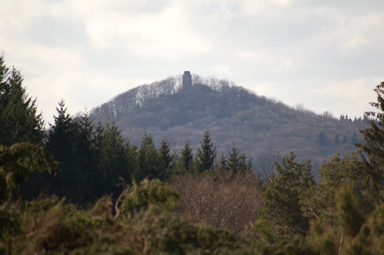
Hohe Acht is Highest peak of the Eifel range at , in the High Eifel nearby west of Koblenz. Research access, facilities, and seasonal conditions with official sources before visiting.
Image: The original uploader was ErnstA at German Wikipedia. Later versions were uploaded by Roßbacher at de.wikipedia. / Wikimedia Commons, CC BY-SA 3.0. Visual context only.
Germany · Central Europe
Hunsrück
Mountain area
Hunsrück is Triangular upland range southwest of Koblenz, bounded by the Moselle, Nahe and Rhine. Research access, facilities, and seasonal conditions with official sources before visiting.
Laacher See is Volcanic crater lake in the East Eifel nearby west of Koblenz. Research access, facilities, and seasonal conditions with official sources before visiting.
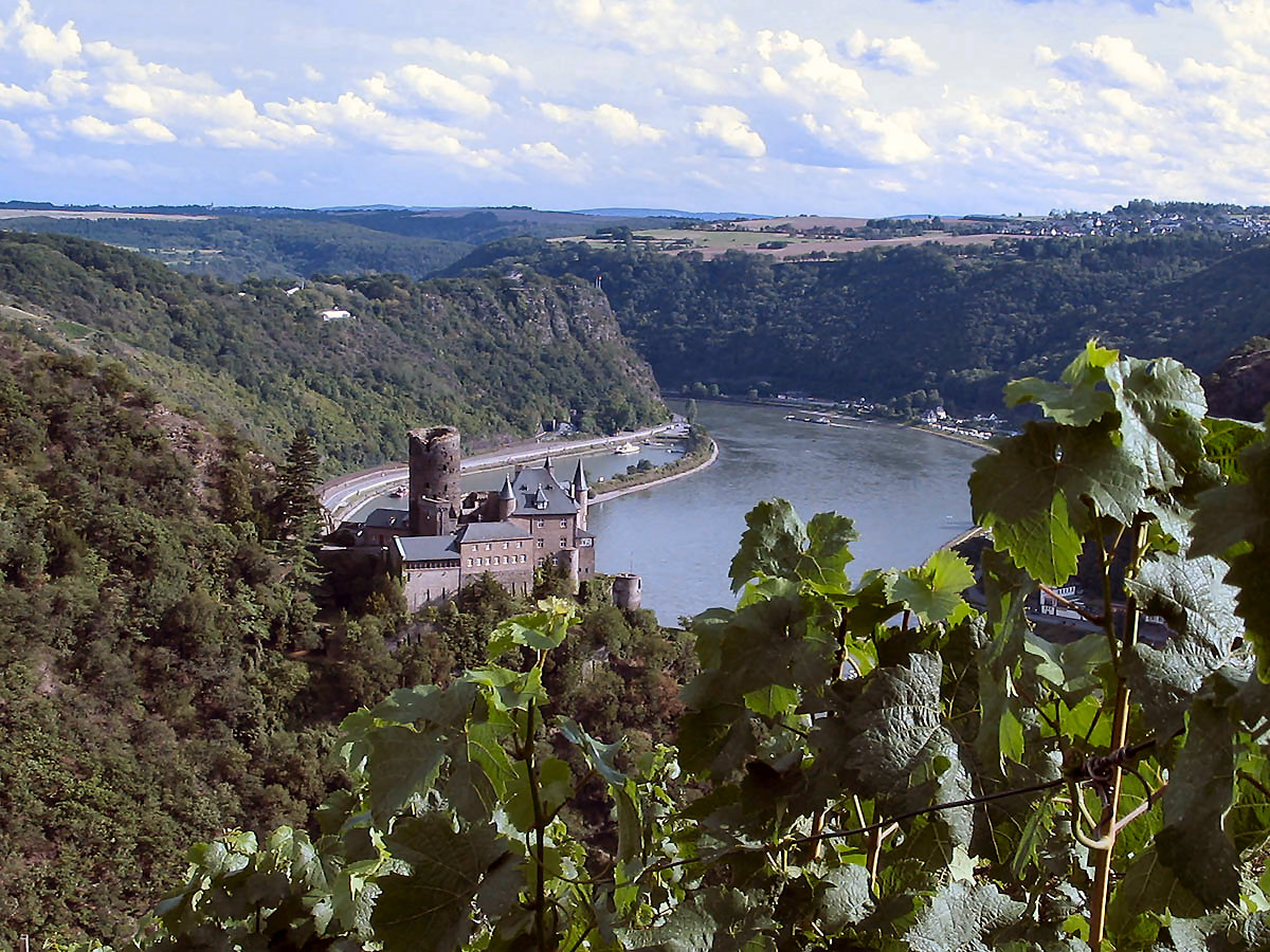
Upper Middle Rhine Valley (Rhine Gorge) is River gorge and valley landscape along the Rhine beginning at Koblenz and extending south, with steep wooded slopes and terraces. Research access, facilities, and seasonal conditions with official sources before visiting.
Volcanic Eifel is Volcanic field region of craters and maar lakes in the Eifel west of Koblenz. Research access, facilities, and seasonal conditions with official sources before visiting.
Westerwald is Forested low mountain range on the right bank of the Rhine, immediately northeast of Koblenz. Research access, facilities, and seasonal conditions with official sources before visiting.
This page is a planning surface. Records do not publish exact distances, travel times, transport schedules, opening hours, ticket prices, restaurant or hotel recommendations, attraction rankings, or live access status.
Start with the Koblenz city profile to anchor the location and country context.
Compare the nearby place records above against your origin city’s transport and access patterns.
Open the detail page for any record marked “Verified source record” to see the official source, Wikidata identity, and visual context.
Check the official source linked on each record for current opening, access, seasonal status, and conditions before departure.
Use the travel budget calculator for user-entered estimates — the platform does not publish ticket prices, transport schedules, or hotel/flight prices.
Confirm route, weather, opening/access status, and costs from official or trusted current sources before departure.
Verification status legend
The status shown on each card reflects the level of source verification: a matched Wikidata identity together with an official URL is shown as verified, an identity match without a confirmed official URL is shown as partially verified, and records not yet matched to a stable identifier are shown as pending review.
Partially verified source record
8
Sources and methodology
Nearby weekend places are sourced exclusively from Wikidata — primary identifier (QID), coordinates (P625), and official website (P856) — together with the linked operator (park authority, municipality, heritage body, or UNESCO official page) where Wikidata’s P856 points at it. Records do not publish fixed itineraries, attraction rankings, restaurant or hotel recommendations, event or festival dates, ticket prices, hotel or flight prices, opening hours, transport schedules, exact travel times, exact distances, weather forecasts, crime rates, or any “best” / “must-see” / “safest” / “cheapest” claims. Verify access, opening times, weather, health, and safety details with the official source linked on each record before departure. Read the scoring methodology for how structured indicators are constructed, and the data sources registry for the official publishers cited across the platform.
Continue exploring
Open related platform layers behind Koblenz weekend research. Verify events, opening hours, transport, weather, health, and safety details with official or trusted current sources before departure.