
Germany · Central Europe
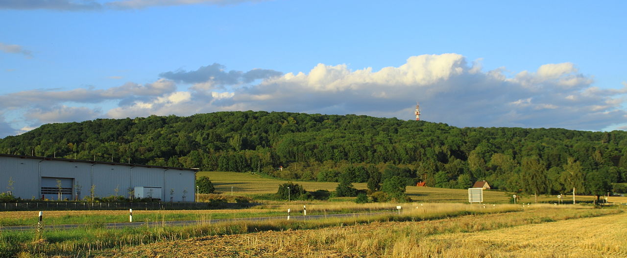
Buchstein
Nature area
Buchstein is a natural area reachable from Bayreuth as a nearby nature destination. Research access, facilities, and seasonal conditions with official sources before visiting.
Verified source record.
Nearby weekend places
Research source-backed public places within weekend reach of Bayreuth. The records on this page are planning candidates — not a route planner, not a tourism ranking, not a live schedule, and not a price guide. Verify access, transport, weather, opening status, and seasonal conditions with the official source linked on each record before departure.
This page helps users research nearby weekend places connected to Bayreuth, Germany, as a starting point for local-first weekend rest. It is not a route planner, ticket guide, events page, tourism ranking, or live availability source. Records are planning candidates only.
Records do not publish exact distances, travel times, transport schedules, opening hours, ticket prices, restaurant or hotel recommendations, attraction rankings, or live access status. Confirm time-sensitive details with the official park, museum, transport authority, or municipal source linked on each record.
Each card opens an official source where Wikidata lists one, plus links to the connected city, country profile, and the detail page for verified records. Records are unordered and not ranked; verify access and conditions with the official source before departure.
Germany · Central Europe
Nature area
Buchstein is a natural area reachable from Bayreuth as a nearby nature destination. Research access, facilities, and seasonal conditions with official sources before visiting.
Verified source record.

Germany · Central Europe
Lake
Craimoosweiher is a lake reachable from Bayreuth as a nearby nature destination. Research access, facilities, and seasonal conditions with official sources before visiting.
Verified source record.

Germany · Central Europe
Mountain area
Franconian Forest is a mountain reachable from Bayreuth as a nearby nature destination. Research access, facilities, and seasonal conditions with official sources before visiting.
Verified source record.
Germany · Central Europe
Nature area
Muschelkalkhänge nordöstlich Bayreuth is a natural area reachable from Bayreuth as a nearby nature destination. Research access, facilities, and seasonal conditions with official sources before visiting.
Verified source record.

Germany · Central Europe
Mountain area
Ochsenkopf is a mountain reachable from Bayreuth as a nearby nature destination. Research access, facilities, and seasonal conditions with official sources before visiting.
Verified source record.
Germany · Central Europe
Mountain area
Oschen Berg is a mountain reachable from Bayreuth as a nearby nature destination. Research access, facilities, and seasonal conditions with official sources before visiting.
Verified source record.

Germany · Central Europe
Nature area
Rhätschluchten westlich Bayreuth is a natural area reachable from Bayreuth as a nearby nature destination. Research access, facilities, and seasonal conditions with official sources before visiting.
Verified source record.

Germany · Central Europe
Lake
Röhrensee is a lake reachable from Bayreuth as a nearby nature destination. Research access, facilities, and seasonal conditions with official sources before visiting.
Verified source record.
This page is a planning surface. Records do not publish exact distances, travel times, transport schedules, opening hours, ticket prices, restaurant or hotel recommendations, attraction rankings, or live access status.
The status shown on each card reflects the level of source verification: a matched Wikidata identity together with an official URL is shown as verified, an identity match without a confirmed official URL is shown as partially verified, and records not yet matched to a stable identifier are shown as pending review.
Nearby weekend places are sourced exclusively from Wikidata — primary identifier (QID), coordinates (P625), and official website (P856) — together with the linked operator (park authority, municipality, heritage body, or UNESCO official page) where Wikidata’s P856 points at it. Records do not publish fixed itineraries, attraction rankings, restaurant or hotel recommendations, event or festival dates, ticket prices, hotel or flight prices, opening hours, transport schedules, exact travel times, exact distances, weather forecasts, crime rates, or any “best” / “must-see” / “safest” / “cheapest” claims. Verify access, opening times, weather, health, and safety details with the official source linked on each record before departure. Read the scoring methodology for how structured indicators are constructed, and the data sources registry for the official publishers cited across the platform.
Open related platform layers behind Bayreuth weekend research. Verify events, opening hours, transport, weather, health, and safety details with official or trusted current sources before departure.