Research source-backed public places within weekend reach of Alexandroupoli. The records on this page are planning candidates — not a route planner, not a tourism ranking, not a live schedule, and not a price guide. Verify access, transport, weather, opening status, and seasonal conditions with the official source linked on each record before departure.
This page helps users research nearby weekend places connected to Alexandroupoli, Greece, as a starting point for local-first weekend rest. It is not a route planner, ticket guide, events page, tourism ranking, or live availability source. Records are planning candidates only.
Records do not publish exact distances, travel times, transport schedules, opening hours, ticket prices, restaurant or hotel recommendations, attraction rankings, or live access status. Confirm time-sensitive details with the official park, museum, transport authority, or municipal source linked on each record.
Each card opens an official source where Wikidata lists one, plus links to the connected city, country profile, and the detail page for verified records. Records are unordered and not ranked; verify access and conditions with the official source before departure.
Dadia-Lefkimi-Soufli Forest National Park is Oak and pine forest national park with low mountains and valleys, a major raptor and vulture habitat, nearby north of Alexandroupoli near Soufli. Research access, facilities, and seasonal conditions with official sources before visiting.
Lake Vistonida is Large shallow lake with brackish and freshwater zones and connected lagoons, a major bird wetland about 85-nearby west of Alexandroupoli between Rhodope and Xanthi. Research access, facilities, and seasonal conditions with official sources before visiting.
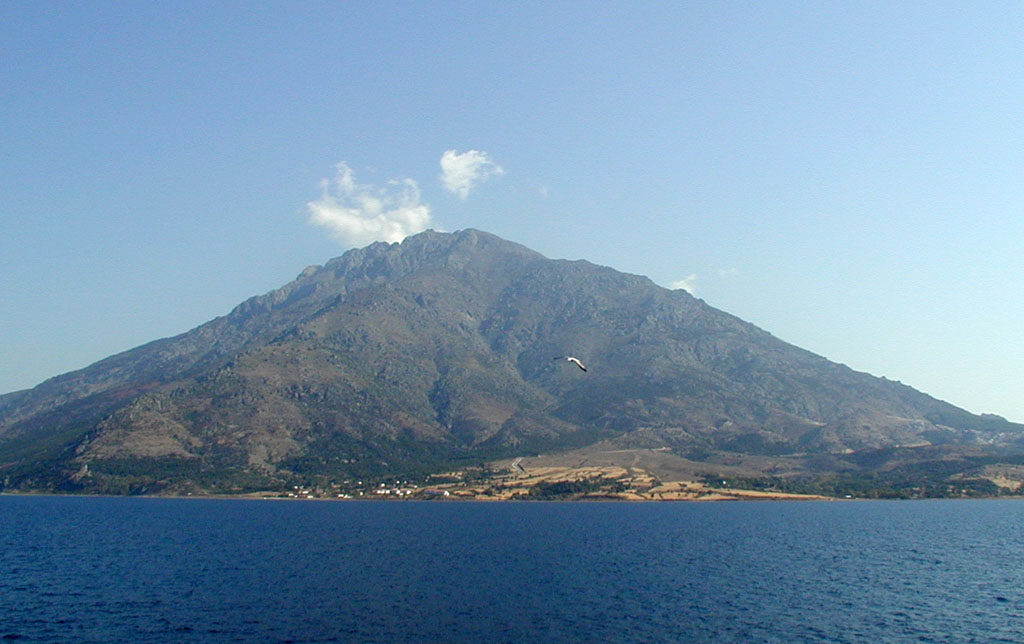
Mount Fengari (Saos) is Highest peak of the Aegean islands at , on the island of Samothrace south of Alexandroupoli, with steep slopes feeding the Fonias gorge and waterfalls. Research access, facilities, and seasonal conditions with official sources before visiting.
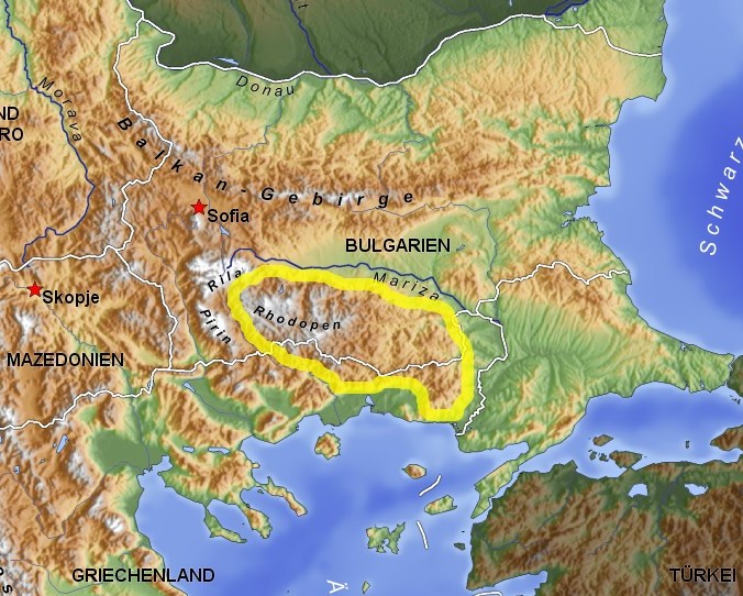
Rhodope Mountains is Forested mountain range with river gorges and karst forming the land border zone north of Alexandroupoli between Greece and Bulgaria. Research access, facilities, and seasonal conditions with official sources before visiting.
Samothrace is Rugged green island in the Thracian Sea with mountain slopes, gorges, springs and waterfalls, nearby south of Alexandroupoli by sea. Research access, facilities, and seasonal conditions with official sources before visiting.
Thracian Sea is Northernmost part of the Aegean Sea fronting the coast of Alexandroupoli, with nearby beaches, capes and the islands of Samothrace and Thasos. Research access, facilities, and seasonal conditions with official sources before visiting.
This page is a planning surface. Records do not publish exact distances, travel times, transport schedules, opening hours, ticket prices, restaurant or hotel recommendations, attraction rankings, or live access status.
Start with the Alexandroupoli city profile to anchor the location and country context.
Compare the nearby place records above against your origin city’s transport and access patterns.
Open the detail page for any record marked “Verified source record” to see the official source, Wikidata identity, and visual context.
Check the official source linked on each record for current opening, access, seasonal status, and conditions before departure.
Use the travel budget calculator for user-entered estimates — the platform does not publish ticket prices, transport schedules, or hotel/flight prices.
Confirm route, weather, opening/access status, and costs from official or trusted current sources before departure.
Verification status legend
The status shown on each card reflects the level of source verification: a matched Wikidata identity together with an official URL is shown as verified, an identity match without a confirmed official URL is shown as partially verified, and records not yet matched to a stable identifier are shown as pending review.
Verified source record
2
Partially verified source record
4
Sources and methodology
Nearby weekend places are sourced exclusively from Wikidata — primary identifier (QID), coordinates (P625), and official website (P856) — together with the linked operator (park authority, municipality, heritage body, or UNESCO official page) where Wikidata’s P856 points at it. Records do not publish fixed itineraries, attraction rankings, restaurant or hotel recommendations, event or festival dates, ticket prices, hotel or flight prices, opening hours, transport schedules, exact travel times, exact distances, weather forecasts, crime rates, or any “best” / “must-see” / “safest” / “cheapest” claims. Verify access, opening times, weather, health, and safety details with the official source linked on each record before departure. Read the scoring methodology for how structured indicators are constructed, and the data sources registry for the official publishers cited across the platform.
Continue exploring
Open related platform layers behind Alexandroupoli weekend research. Verify events, opening hours, transport, weather, health, and safety details with official or trusted current sources before departure.